|
|
| Mesoscale Discussion 2041 | |
| < Previous MD | |

|
|
   Mesoscale Discussion 2041
   NWS Storm Prediction Center Norman OK
   1254 PM CDT Sun Sep 01 2024

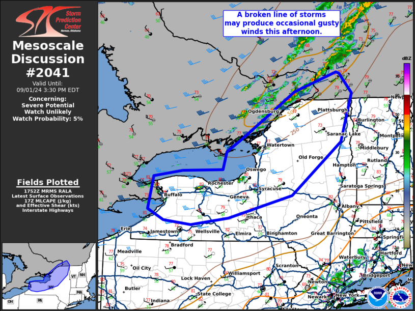
   Areas affected...parts of western and northern New York

   Concerning...Severe potential...Watch unlikely

   Valid 011754Z - 011930Z

   Probability of Watch Issuance...5 percent

   SUMMARY...A broken line of storms may produce occasional gusty wind
   this afternoon.

   DISCUSSION...Inhibition has been mostly eroded across western and
   northern New York as temperatures have warmed to the upper 70s to
   low 80s with mid 60s dewpoints. Expect scattered thunderstorms to
   develop along a cold front once it moves east of Lake Erie and Lake
   Ontario. Storms may be not be that deep given the relatively shallow
   thermodynamic profile shown by the RAP forecast soundings. However,
   relatively strong flow through the column and a well-mixed boundary
   layer may support efficient transport of gusty winds to the surface
   within these storms. Isolated damaging wind gusts are possible
   through the afternoon with this threat waning near sunset.

   ..Bentley/Bunting.. 09/01/2024

   ...Please see www.spc.noaa.gov for graphic product...

   ATTN...WFO...BTV...ALY...BGM...BUF...

   LAT...LON   43357915 43497832 43517714 43907704 44207653 44667583
               45167503 45587378 45557370 45137334 44107369 42977513
               42497697 42337806 42427885 42657931 43357915
|
|
|
Top/All Mesoscale Discussions/Forecast Products/Home |
|


