|
|
| Mesoscale Discussion 2040 | |
| < Previous MD | |

|
|
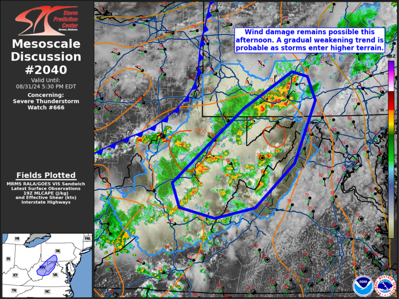
Mesoscale Discussion 2040 NWS Storm Prediction Center Norman OK 0228 PM CDT Sat Aug 31 2024 Areas affected...Eastern West Virginia...far Northwest Virginia...western Maryland...south-central Pennsylvania Concerning...Severe Thunderstorm Watch 666... Valid 311928Z - 312130Z The severe weather threat for Severe Thunderstorm Watch 666 continues. SUMMARY...Wind damage will remain possible with the strongest storms as they continue east into the Appalachians. A gradual weakening trend is expected as they encounter a more stable environment. No additional watches are expected this afternoon. DISCUSSION...A broken line of semi-organized convection continues eastward into the Mid-Atlantic region this afternoon. The strongest cluster is currently located in south-central Pennsylvania. Scattered weaker storms are also evident within the Appalachians, ahead of the primary band of convection. These storms will likely act to limit storm intensity due to outflow cooling the airmass. Farther east, low-level cloud cover has remained entrenched up against the Blue Ridge. While wind damage will remain possible this afternoon, storms are expected to undergo gradual weakening with time as the environment is increasingly stable with eastward extent. No additional watches are expected this afternoon. ..Wendt.. 08/31/2024 ...Please see www.spc.noaa.gov for graphic product... ATTN...WFO...CTP...LWX...RNK...PBZ...RLX... LAT...LON 37888020 38088101 38528119 39198038 39877954 40527842 40447805 40007788 38887838 38087928 37888020 |
|
|
Top/All Mesoscale Discussions/Forecast Products/Home |
|


