|
|
| Mesoscale Discussion 1990 | |
| < Previous MD | |

|
|
   Mesoscale Discussion 1990
   NWS Storm Prediction Center Norman OK
   0539 PM CDT Sun Aug 25 2024

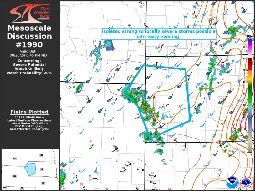
   Areas affected...Northeast WY into western SD and extreme southeast
   MT

   Concerning...Severe potential...Watch unlikely

   Valid 252239Z - 260045Z

   Probability of Watch Issuance...20 percent

   SUMMARY...Isolated strong to severe storms are possible into early
   evening.

   DISCUSSION...Some recent intensification has been noted as a cluster
   of high-based convection and related outflow have moved into a
   post-frontal regime across the Black Hills. Short-term evolution of
   this convection remains uncertain, with more favorable
   moisture/instability with eastward extent, but also substantial
   CINH. However, with relatively steep low/midlevel lapse rates and
   favorable deep-layer shear in place, some increase in storm coverage
   and organization is possible. Strong to locally severe storms
   capable of localized severe gusts and hail will be possible into
   early evening. Watch issuance is currently considered unlikely, but
   will be reevaluated if trends support a more-organized severe
   threat.

   ..Dean/Gleason.. 08/25/2024

   ...Please see www.spc.noaa.gov for graphic product...

   ATTN...WFO...UNR...BYZ...

   LAT...LON   44680505 45630417 45500213 43750193 43140380 44250441
               44680505
|
|
|
Top/All Mesoscale Discussions/Forecast Products/Home |
|


