|
|
| Mesoscale Discussion 1983 | |
| < Previous MD | |

|
|
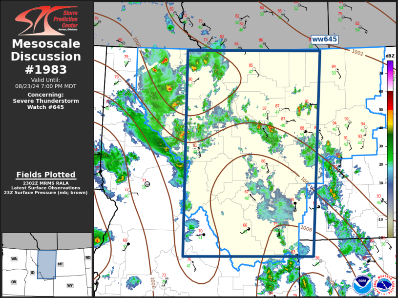
Mesoscale Discussion 1983 NWS Storm Prediction Center Norman OK 0604 PM CDT Fri Aug 23 2024 Areas affected...Western Montana Concerning...Severe Thunderstorm Watch 645... Valid 232304Z - 240100Z The severe weather threat for Severe Thunderstorm Watch 645 continues. SUMMARY...Severe wind gust potential continues with convection this evening. DISCUSSION...Satellite imagery depicts a well-defined short-wave trough, extending from northeast OR-ID-extreme western WY, lifting north across the northern Rockies. Large-scale height falls are noted ahead of this feature as 500mb flow on the order of 50kt translates across the Bitter Roots into western MT. An arcing corridor of scattered robust convection has developed ahead of the short wave, and while this activity is developing within a weak-instability airmass, severe gusts have been common. Over the next few hours it appears the primary area of concern will extend across northern portions of ww645 where instability has yet to be overturned. ..Darrow.. 08/23/2024 ...Please see www.spc.noaa.gov for graphic product... ATTN...WFO...BYZ...RIW...TFX...PIH...MSO... LAT...LON 44641447 48961445 48961029 44651061 44641447 |
|
|
Top/All Mesoscale Discussions/Forecast Products/Home |
|


