|
|
| Mesoscale Discussion 1979 | |
| < Previous MD | |

|
|
   Mesoscale Discussion 1979
   NWS Storm Prediction Center Norman OK
   0353 PM CDT Fri Aug 23 2024

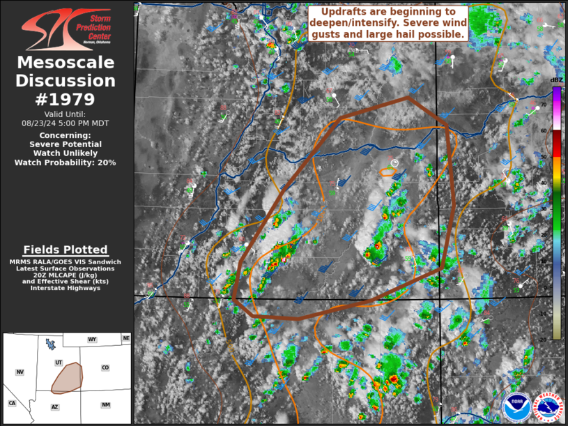
   Areas affected...Portions of southern/eastern Utah into far western
   Colorado

   Concerning...Severe potential...Watch unlikely

   Valid 232053Z - 232300Z

   Probability of Watch Issuance...20 percent

   SUMMARY...Scattered storms, some capable of severe winds and large
   hail, will occur this afternoon. A watch is not currently
   anticipated.

   DISCUSSION...Early cloud cover within the Colorado Plateau has kept
   temperatures in the mid/upper 70s F thus far. Even so, colder air
   aloft has promoted around 1000 J/kg MLCAPE in southeastern Utah.
   Convection has shown signs of deepening on MRMS CAPPI imagery. Some
   further intensification of this activity is possible as temperatures
   will still rise this afternoon. Moderate mid-level flow on the
   eastern flank of the upper low will foster 45-50 kts of effective
   shear and at least marginal supercell structures. Storms will be
   capable of severe wind gusts and possibly large hail.

   ..Wendt/Guyer.. 08/23/2024

   ...Please see www.spc.noaa.gov for graphic product...

   ATTN...WFO...GJT...FGZ...SLC...

   LAT...LON   37461224 38391155 39331063 39590951 39220889 38200878
               37400900 36991014 36741130 36771203 36981233 37461224
|
|
|
Top/All Mesoscale Discussions/Forecast Products/Home |
|


