|
|
| Mesoscale Discussion 1957 | |
| < Previous MD | |

|
|
   Mesoscale Discussion 1957
   NWS Storm Prediction Center Norman OK
   0224 PM CDT Mon Aug 19 2024

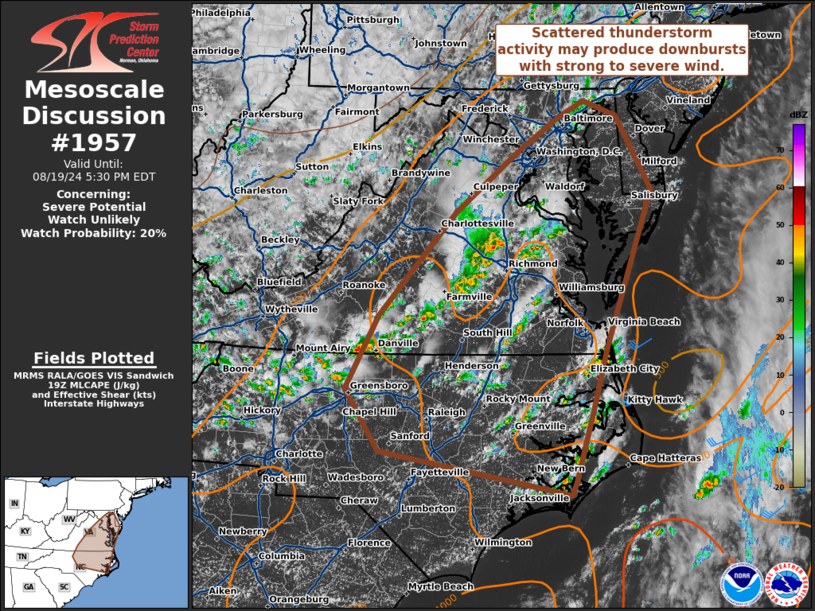
   Areas affected...Virginia and portions of North Carolina

   Concerning...Severe potential...Watch unlikely

   Valid 191924Z - 192130Z

   Probability of Watch Issuance...20 percent

   SUMMARY...Scattered thunderstorm activity will have potential to
   produce downbursts with strong to severe gusts.

   DISCUSSION...Thunderstorm activity has increased in coverage across
   Virginia and North Carolina this afternoon as lift from a mid-level
   trough overspreads a cold front across the region. Breaks in morning
   cloud cover have allowed for sufficient daytime heating and
   temperatures in the mid to upper 80s, with low-level lapse rates
   around 8 C/km. MLCAPE around 1000-1500 J/kg is analyzed in RAP
   objective analysis. While deep layer shear is weak, steep lapse
   rates and precipitable water values above 1 inch will support
   potential for a few strong storms with potential for downbursts
   capable of strong to severe gusts. Overall, this threat will likely
   remain too localized for watch issuance.

   ..Thornton/Hart.. 08/19/2024

   ...Please see www.spc.noaa.gov for graphic product...

   ATTN...WFO...PHI...AKQ...MHX...LWX...RAH...RNK...

   LAT...LON   36117983 36997936 38257821 38977726 39367670 39577629
               39397579 38517527 37817552 36627595 35907616 35037641
               34857648 35387934 36117983
|
|
|
Top/All Mesoscale Discussions/Forecast Products/Home |
|


