|
|
| Mesoscale Discussion 1953 | |
| < Previous MD | |

|
|
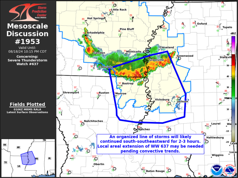
Mesoscale Discussion 1953 NWS Storm Prediction Center Norman OK 0809 PM CDT Sun Aug 18 2024 Areas affected...Northeast Louisiana into portions of west-central/southwest Mississippi Concerning...Severe Thunderstorm Watch 637... Valid 190109Z - 190315Z The severe weather threat for Severe Thunderstorm Watch 637 continues. SUMMARY...Damaging winds are possible with a line of convection moving south-southeastward into portions of central Mississippi and northeast Louisiana. DISCUSSION...An line of convection has organized along outflow from earlier storms in central/southeast Arkansas. The 00Z observed sounding from Jackson, MS, showed 2000+ MLCAPE with minimal MLCIN and 34 kts effective shear. Though some diurnal cooling will occur, the overall organization of the cold pool should allow strong to severe storms to continue for another 2-3 hours. Damaging winds will likely be the main threat given the transition to a linear mode. It is possible this line of storms could approach the southern edge of WW 637 before 03Z. Depending on convective trends, this may warrant an extension in area and/or time of WW 637. ..Wendt.. 08/19/2024 ...Please see www.spc.noaa.gov for graphic product... ATTN...WFO...JAN...LZK...SHV... LAT...LON 33239231 33359188 33599098 33699045 32548989 31948994 31779061 31809145 31859195 31979204 32139206 33239231 |
|
|
Top/All Mesoscale Discussions/Forecast Products/Home |
|


