|
|
| Mesoscale Discussion 1935 | |
| < Previous MD Next MD > | |

|
|
   Mesoscale Discussion 1935
   NWS Storm Prediction Center Norman OK
   0457 PM CDT Sat Aug 17 2024

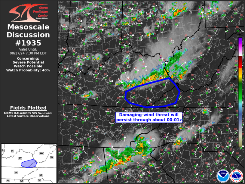
   Areas affected...Southeast KY and extreme western VA

   Concerning...Severe potential...Watch possible

   Valid 172157Z - 172330Z

   Probability of Watch Issuance...40 percent

   SUMMARY...Damaging-wind threat will persist across southeast
   Kentucky and far western Virginia through 00-01z.

   DISCUSSION...A band of thunderstorms is spreading southeastward
   across eastern KY on an aggregate convective outflow, in association
   with the southern extent of a midlevel shortwave trough.  Surface
   temperatures remain in the mid-upper 80s to the south of the ongoing
   storms, where MLCAPE is near 2000 J/kg.  The combination of the
   moderate-strong buoyancy and lingering/steep low-level lapse rates,
   along with 30-40 kt midlevel flow per regional VWPs, will support a
   continued threat for occasional wind damage with embedded
   downbursts.  Gradual cooling of the boundary layer will result in a
   slow decrease in the severe threat near and after sunset.

   ..Thompson/Guyer.. 08/17/2024

   ...Please see www.spc.noaa.gov for graphic product...

   ATTN...WFO...RLX...MRX...JKL...

   LAT...LON   37758242 37528213 37218188 36778209 36638265 36598354
               36778436 36948457 37208455 37418406 37758242
|
|
|
Top/All Mesoscale Discussions/Forecast Products/Home |
|


