|
|
| Mesoscale Discussion 1921 | |
| < Previous MD | |

|
|
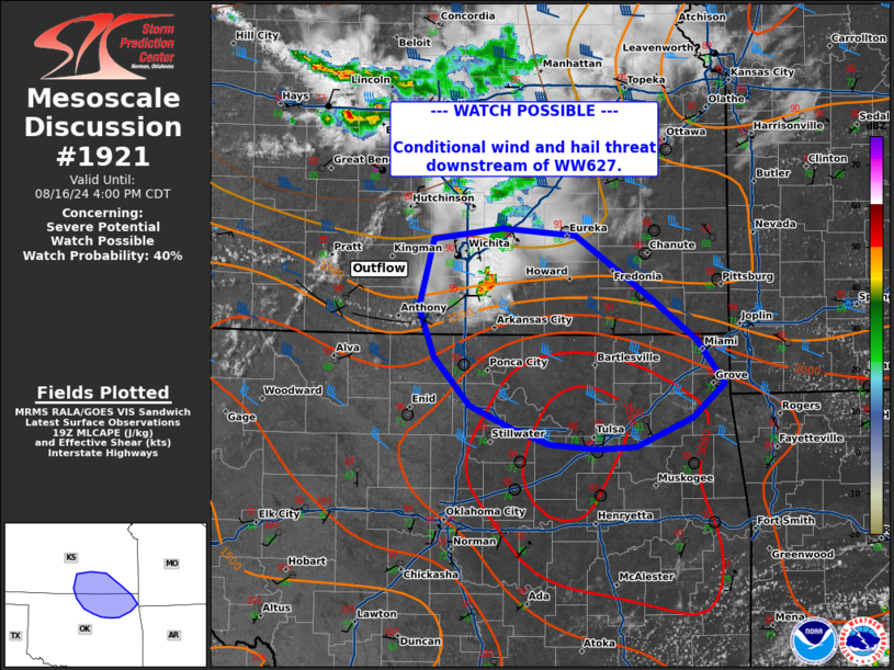
Mesoscale Discussion 1921 NWS Storm Prediction Center Norman OK 0207 PM CDT Fri Aug 16 2024 Areas affected...south-central Kansas into northeast Oklahoma Concerning...Severe potential...Watch possible Valid 161907Z - 162100Z Probability of Watch Issuance...40 percent SUMMARY...A conditional threat of wind and hail will be possible downstream of WW627 as long-lived supercell and potential for additional convection develops continues east and southeast. DISCUSSION...An elevated long-lived supercell continues to track east along trailing outflow in south-central Kansas south of Wichita. Visible satellite has shown attempts at new cell development on the southern flank of outflow as it sags southward towards northern Oklahoma. Modified soundings would suggest that the downstream environment may only be weakly capped, as temperatures have warmed into the low to mid 90s across much of eastern Kansas and northern Oklahoma. A conditional threat of large hail and damaging wind may extend downstream with further warming and weakening of capping occurs and supercells can become surface based, given MLCAPE around 1000-3000 J/kg and deep layer shear 35-40 kts. This area is being monitored for a downstream watch should intensification occur. A local extension of WW627 may be needed in south-central Kansas. ..Thornton/Thompson.. 08/16/2024 ...Please see www.spc.noaa.gov for graphic product... ATTN...WFO...SGF...TSA...ICT...OUN... LAT...LON 36809765 36419729 36219684 36099647 36049597 36069558 36309499 36599467 36949495 37299541 37819620 37889696 37789767 37219781 36809765 |
|
|
Top/All Mesoscale Discussions/Forecast Products/Home |
|


