|
|
| Mesoscale Discussion 1883 | |
| < Previous MD | |

|
|
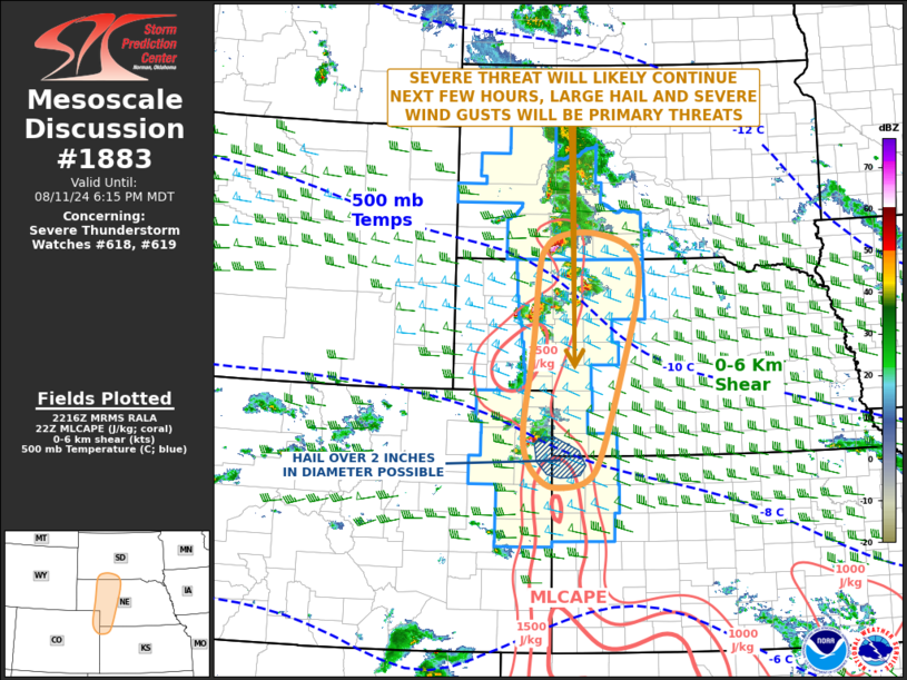
Mesoscale Discussion 1883 NWS Storm Prediction Center Norman OK 0518 PM CDT Sun Aug 11 2024 Areas affected...Far Southwest South Dakota...Western Nebraska...Northeast Colorado...Far Northwest Kansas Concerning...Severe Thunderstorm Watch 618...619... Valid 112218Z - 120015Z The severe weather threat for Severe Thunderstorm Watch 618, 619 continues. SUMMARY...A threat for large hail and severe wind gusts will continue across the central Plains over the next few hours. There is a localized potential for hail over 2 inches in diameter. DISCUSSION...Water vapor imagery shows northwest flow over much of the central U.S., with a subtle shortwave trough moving through the central High Plains. At the surface, a quasi-stationary front is located from southwestern South Dakota extending southward into far eastern Colorado. Scattered to widely scattered thunderstorms are ongoing just to the east of the boundary. The RAP suggests that the storms are near an axis of instability, with MLCAPE just to the east of the front estimated to be in the 1000 to 2000 J/kg range. In addition, regional WSR-88D VWPs also show moderate deep-layer shear in place across much of the central High Plains. 0-6 km shear appears to be in the 40 to 50 knot range along and near the instability axis. This will continue to support supercell development over the next few hours. Severe wind gusts and isolated large hail will be the primary threats. Hailstones of greater than 2 inches in diameter will be possible locally, mainly over far northeast Colorado and far northwest Kansas, where the combination of instability and shear appears to be maximized. ..Broyles.. 08/11/2024 ...Please see www.spc.noaa.gov for graphic product... ATTN...WFO...LBF...UNR...GLD...BOU... LAT...LON 41640244 40420263 39900254 39570221 39510183 39620134 40040105 41390060 42350032 42910030 43230057 43410129 43350191 43170218 42840231 41640244 |
|
|
Top/All Mesoscale Discussions/Forecast Products/Home |
|


