
Headlines
- Debby is causing localized catastrophic flooding in parts of northern Pennsylvania and the Southern Tier of New York.
- Debby’s remnants will exit into Canada tonight, bringing more flooding risks to Quebec, including Montreal, as well as northern New York and northern Vermont.
- The next wave has increasing development odds in the Atlantic.
- While no development is expected before Monday, interests in the Leeward Islands, Puerto Rico, and Virgin Islands should monitor this wave’s progress closely.
Debby on the way out
Debby, no longer a tropical storm, is exiting to the north today, but not before leaving more destruction in its wake. Several flash flood emergencies are ongoing in Pennsylvania and New York this afternoon as Debby’s rains lead to damaging flooding, including reports of rooftop rescues and numerous trapped people in Westfield, PA.
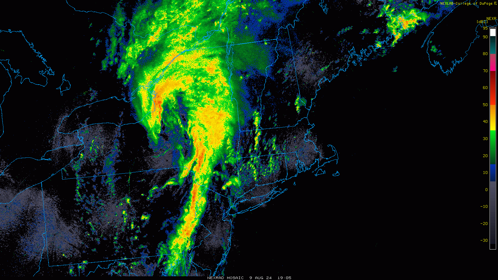
Debby’s remnants will move into Canada and bring more flooding rain, with rainfall warnings hoisted for much of southern Quebec and parts of New Brunswick as well. Portions of northern Vermont, very vulnerable to rainfall are also under a flood watch as Debby’s rains move that way. Isolated tornadoes are possible as well.
Watching the next wave’s development odds increase
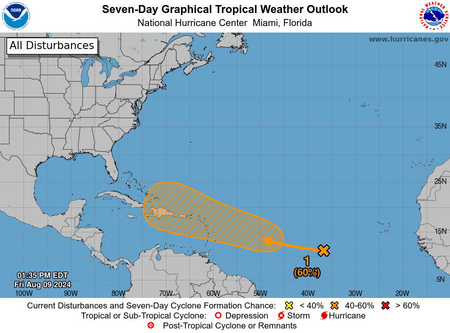
As I noted yesterday, I felt that the 30 percent odds of development from the next Atlantic wave were going to increase. A little over 24 hours later, and those odds are now doubled up to 60 percent.
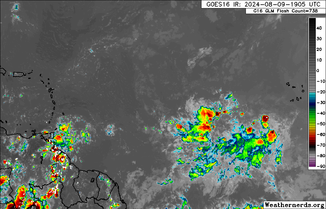
The tropical wave itself is not much to look at today, just an area of clouds, showers, and thunderstorms in an otherwise rather dusty Atlantic. You can see it east of the islands on the satellite image below.
The first thing I can tell you about this one is that we do not expect any development probably before later Monday. So we have a couple days yet before this gets started. So for folks in the islands, this will probably not be bearing down on you as a big storm; it will probably just be getting organized as it arrives. Whatever the case, by Monday, we have a tropical wave on the cusp of organization, arriving just east of the Lesser Antilles and Virgin Islands.
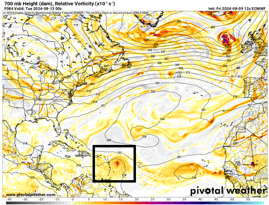
From here, the ballet begins. High pressure over the Southern U.S. and Texas, a trough digging into New England, and high pressure in the Atlantic will compete as this wave develops to help steer it. The current majority of modeling suggests this will develop steadily enough that it will probably go north in the islands and eventually into the open Atlantic. However, given that we’re about 6 days or so out from that happening and the inherent uncertainty from an undeveloped system, we can’t say much for sure. Here’s what we can tell you today:
- The tropical wave is unlikely to develop before Monday.
- Development may occur steadily, if not rapidly as the system enters the Caribbean or grazes the northeast Caribbean next week.
- While the model consensus suggests an eventual north turn well off the East Coast, it is far too early to say much about this system’s future track.
- A Gulf of Mexico track is unlikely at this time but not an impossibility.
I feel like when storms have had an opportunity to come a little farther west than expected this season, they’ve found a way, so I don’t want to write this off for Florida or the East Coast just yet. Right now, folks in the Leeward Islands, Puerto Rico, and the Virgin Islands should be watching this system closely, as once it gets going, it could start organizing fairly quickly. Beyond that, stay tuned this weekend for the latest. We’ll have another update for you on Sunday.
Source link