|
|
| Mesoscale Discussion 1855 | |
| < Previous MD | |

|
|
   Mesoscale Discussion 1855
   NWS Storm Prediction Center Norman OK
   0155 AM CDT Wed Aug 07 2024

   Areas affected...Southeast NC into extreme northeast SC

   Concerning...Severe potential...Watch unlikely

   Valid 070655Z - 071000Z

   Probability of Watch Issuance...20 percent

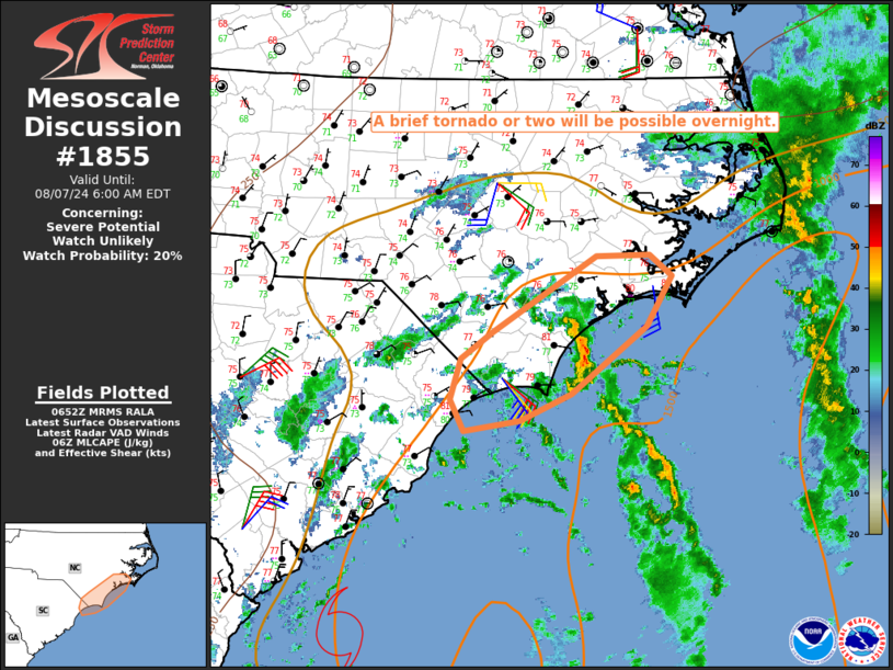
   SUMMARY...A brief tornado or two will be possible overnight.

   DISCUSSION...A band of convection along the east/northeast periphery
   of Tropical Storm Debby's circulation has become somewhat more
   well-defined early this morning. A theta-e/instability gradient
   persists near the coast, with a narrow inland zone of MLCAPE near
   1000 J/kg noted (per recent objective mesoanalyses and a modified
   06Z sounding from KMHX) where temperatures remain near 80 F.

   The 06Z MHX sounding and recent VWPs from KMHX/KLTX depict 0-1 km
   SRH of around 150-200 m2/s2 for observed cell motions, which is
   sufficient to support at least transient low-level rotation with the
   strongest cells. While ongoing convection has generally struggled to
   become organized, a brief tornado or two cannot be ruled out
   overnight as stronger embedded cells within the primary convective
   band move inland and cross the near-coastal baroclinic zone.

   ..Dean/Edwards.. 08/07/2024

   ...Please see www.spc.noaa.gov for graphic product...

   ATTN...WFO...MHX...ILM...

   LAT...LON   34147884 34387852 35037745 35037690 34857667 34427693
               33847770 33627823 33527882 33797896 34147884
|
|
|
Top/All Mesoscale Discussions/Forecast Products/Home |
|


