|
|
| Mesoscale Discussion 1822 | |
| < Previous MD | |

|
|
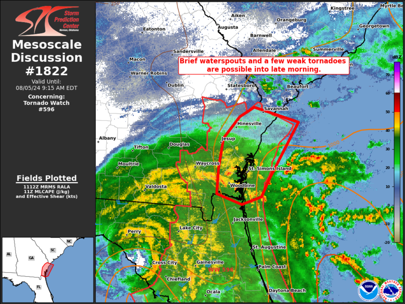
Mesoscale Discussion 1822 NWS Storm Prediction Center Norman OK 0613 AM CDT Mon Aug 05 2024 Areas affected...coastal GA vicinity Concerning...Tornado Watch 596... Valid 051113Z - 051315Z The severe weather threat for Tornado Watch 596 continues. SUMMARY...Potential for a few waterspouts and brief/weak tornadoes should be focused along the coastal Georgia vicinity through late morning. DISCUSSION...Convection has blossomed over the past couple hours off the GA and FL Atlantic coast. Some of this activity has been drawn northwestward, as an outer band structure downstream of TC Debby. The most persistent near-term band will probably remain just north of the coastal GA-FL border, with weak, transient circulations ongoing from southern Camden County, GA offshore. Additional banding within lower-topped convection may also occur farther north towards the coastal GA-SC border through the rest of the morning. While the degree of instability is weak, but likely improved slightly from the 06Z JAX/CHS soundings, the presence of a couple-county wide ribbon of upper 70s surface dew points across coastal southeast GA will contribute to regenerative updrafts over the next few hours. Enhanced low-level hodograph curvature within the northeast quadrant of slow-moving Debby will favor threats for offshore waterspouts and perhaps a few brief tornadoes this morning. ..Grams.. 08/05/2024 ...Please see www.spc.noaa.gov for graphic product... ATTN...WFO...CHS...JAX... LAT...LON 30738112 30618149 30788194 31188191 31668182 32008152 32168125 31928043 31028098 30738112 |
|
|
Top/All Mesoscale Discussions/Forecast Products/Home |
|
Source link


