|
|
| Mesoscale Discussion 1807 | |
| < Previous MD Next MD > | |

|
|
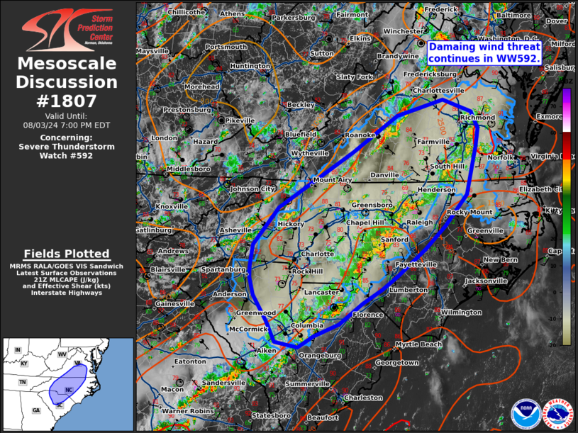
Mesoscale Discussion 1807 NWS Storm Prediction Center Norman OK 0427 PM CDT Sat Aug 03 2024 Areas affected...Northern Southern Carolina...Central North Carolina...Central Virginia Concerning...Severe Thunderstorm Watch 592... Valid 032127Z - 032300Z The severe weather threat for Severe Thunderstorm Watch 592 continues. SUMMARY...Damaging wind threat continues in WW592. DISCUSSION...A line of thunderstorms continues from east-central Virginia into the Carolinas producing occasional damaging winds (e.g., tree damage). This line has generally been moving north-northeast, and a local extensions to WW592 may be utilized, though surface objective analysis indicates mid-level capping remains in place further eastward across NC/VI. This leads to some uncertainty in how long storms will maintain severe characteristics with eastward extent. Occasional severe winds can be expected in the near term with this line. Further west along the front, additional storm development may be possible. Due to the more discrete nature of this convection, potential for large hail and damaging wind will be possible. ..Thornton.. 08/03/2024 ...Please see www.spc.noaa.gov for graphic product... ATTN...WFO...AKQ...LWX...RAH...ILM...RNK...CAE...GSP... LAT...LON 34168152 34598179 34908187 35078187 35468182 36108128 37067971 37677877 37947780 37737719 37447706 37157711 36317732 35797778 35387821 34947877 34707912 34467952 34108000 33898054 33708086 33808133 34168152 |
|
|
Top/All Mesoscale Discussions/Forecast Products/Home |
|


