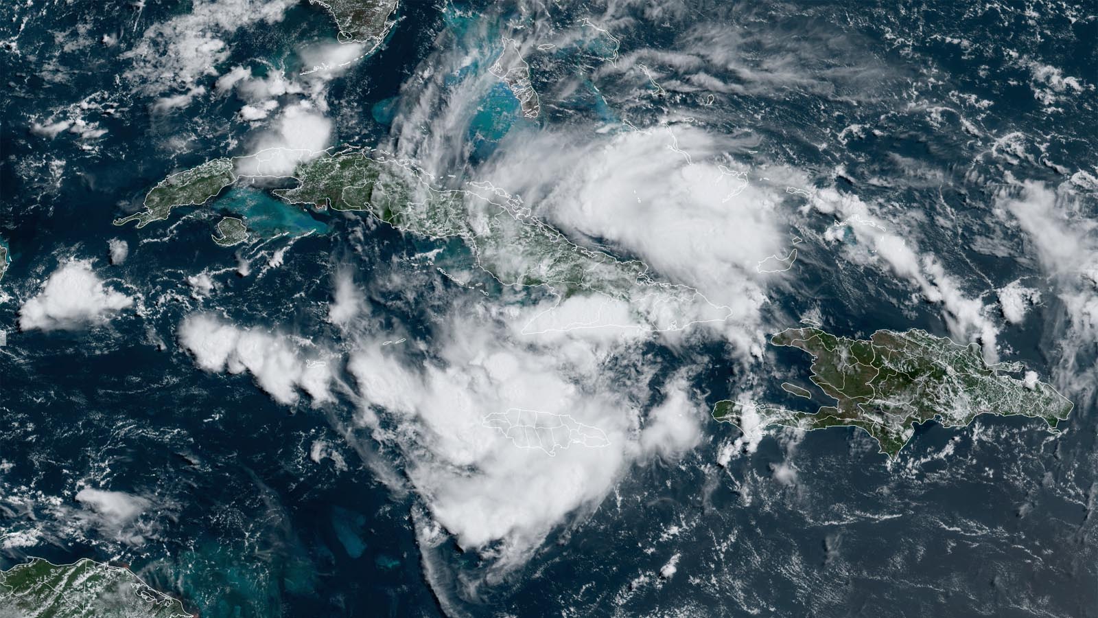
Tropical Storm Warning flags are flying for portions of the west coast of Florida as a large tropical wave, located over southeastern Cuba on Friday afternoon, heads toward the Gulf of Mexico and an expected landfall in western Florida on Sunday or Monday. Formerly labeled Invest 97L, the National Hurricane Center, or NHC, christened the disturbance Potential Tropical Cyclone 4, or PTC 4, at 11 a.m. EDT Friday. The PTC designation is used for systems that could bring tropical storm or hurricane conditions to land areas within 48 hours but that are not yet tropical cyclones.
PTC 4 slowly growing more organized
At 11 a.m. EDT Friday, PTC 4 was located 420 miles southeast of Key West, Florida, moving west-northwest at 16 mph, with top sustained winds of 30 mph and a central pressure of 1,012 mb. Satellite imagery showed that the disturbance had a large area of heavy thunderstorms with a modest degree of rotation, which were slowly growing more organized. Dry air was interfering with organization, as was passage over the high mountains of Cuba. Conditions were otherwise favorable for development, with near-record ocean temperatures near 29.5 degrees Celsius (85°F) and light wind shear of 5-10 knots.
Forecast for PTC 4
The course of PTC 4 over the next week or more will be shaped by three systems, all located to its north:
- a strong ridge of high pressure across the Western and Central U.S.
- a strong ridge in the Atlantic associated with the Azores-Bermuda High
- a weakness in between (a trough of low pressure)
At first, PTC 4 will be steered mainly by the Atlantic ridge, which was driving the system west-northwest along the length of Cuba on Friday. Along this track, PTC 4 will encounter an increasingly moist environment, with the humidity projected to climb from 55% on Friday morning to 65% by Saturday evening. Wind shear should remain light to moderate through the weekend, and land interaction with the islands will decrease as PTC 4 emerges into the open southeastern Gulf on Saturday. These conditions should allow PTC 4 to become Tropical Storm Debby by Saturday night.
The models have come into better agreement that an upper-level trough approaching the U.S. East Coast this weekend will turn PTC 4 to the northwest on Friday night or Saturday morning and then northward on Sunday, resulting in a landfall along the Florida west coast or Big Bend area on Sunday or Monday. At present, there is little model support for PTC 4 becoming a hurricane, since the storm has a relatively large circulation that will take time to consolidate, and it doesn’t have much time over water before landfall. The 11 a.m. EDT Friday official forecast from NHC called for PTC 4 to peak as a strong tropical storm with 65 mph winds on Sunday night, just before landfall.
A heavy rain threat for Florida
Steering currents are likely to weaken on Sunday and Monday, and PTC 4 is expected to slow from its current forward speed of 15 mph to a sedate 5-10 mph. This slow forward motion will give PTC 4 plenty of time to dump very heavy rains, and freshwater flooding is likely to be the storm’s main threat. Sea surface temperatures in the eastern Gulf of Mexico are record warm and will provide plenty of moisture to feed heavy rains: four to eight inches of rain is possible along portions of the Florida west coast, with isolated amounts up to 12 inches.
Long-range forecast for PTC 4
The most probable long-range fate of PTC 4 will be for it to emerge off the northeast coast of Florida over the open Atlantic early next week, then head northeast along the Southeast U.S. coast and out to sea. Heavy rains, high seas, and other impacts are likely along eastern Georgia and the Carolina coasts as the week unfolds, depending on how far offshore (or how far inland) PTC 4 tracks and how slowly it moves. The storm could also be a threat to the Canadian Maritime Provinces late in the week.
A minority of the members of the GFS and European model ensembles show that the trough of low pressure pulling PTC 4 to the northeast may not be strong enough to finish the job, leaving PTC 4 stranded on a region of weak steering currents near the Southeast U.S. coast. In this scenario, PTC 4 could subject the coast to an extended period of heavy rain, with potential serious flood impacts.
In its Tropical Weather Outlook issued at 8 a.m. EDT Friday, the National Hurricane Center gave PTC 4 a 70% chance of becoming at least a tropical depression by Sunday, and a 90% chance by next Friday. The first hurricane-hunter flight into the center of PTC 4 is set for Saturday afternoon, but a NOAA aircraft is tasked with sampling the storm’s surrounding environment on Friday afternoon in order to improve model predictions.
We help millions of people understand climate change and what to do about it. Help us reach even more people like you.
Source link


