2024-07-06 16:13:03
1720297703
|
|
| Mesoscale Discussion 1544 | |
| < Previous MD | |

|
|
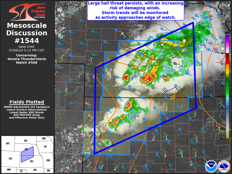
Mesoscale Discussion 1544 NWS Storm Prediction Center Norman OK 0311 PM CDT Sat Jul 06 2024 Areas affected...much of central Nebraska into northwest Kansas Concerning...Severe Thunderstorm Watch 508... Valid 062011Z - 062215Z The severe weather threat for Severe Thunderstorm Watch 508 continues. SUMMARY...Scattered severe storms producing mainly large hail persist over much of south-central Nebraska into northwest Kansas. Areas over eastern Nebraska and northeast Kansas will be monitored for additional watch potential, depending on storm trends. DISCUSSION...A cluster of severe hail storms persists along the warm front over southern Nebraska, with additional activity within the warmer air mass into northwest Kansas. Instability is a bit weaker east of the watch, but a continuation of severe risk is expected later this evening as storms become organized with traveling cold pool. Farther south across western Kansas, visible satellite shows high-based CU along the Colorado/Kansas border, and isolated cells may eventually form here producing localized hail and wind. ..Jewell.. 07/06/2024 ...Please see www.spc.noaa.gov for graphic product... ATTN...WFO...OAX...TOP...GID...LBF...DDC...GLD... LAT...LON 39679764 38270159 40890162 42279767 39679764 |
|
|
Top/All Mesoscale Discussions/Forecast Products/Home |
|