2024-07-03 00:10:05
1719980057
|
|
| Mesoscale Discussion 1518 | |
| < Previous MD | |

|
|
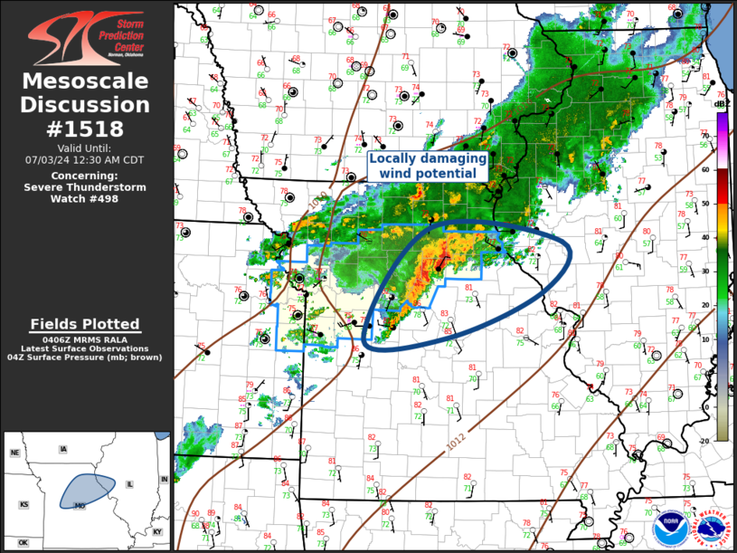
Mesoscale Discussion 1518 NWS Storm Prediction Center Norman OK 1107 PM CDT Tue Jul 02 2024 Areas affected...Northern MO...Western IL Concerning...Severe Thunderstorm Watch 498... Valid 030407Z - 030530Z The severe weather threat for Severe Thunderstorm Watch 498 continues. SUMMARY...Locally damaging winds will accompany convection as it propagates across northeast MO into western IL. DISCUSSION...Weak MCV has evolved within remnant convection that tracked across eastern KS into northwest MO, just east of Kansas City over Ray County. This feature may be partly responsible for organized squall line that currently extends from near Sedalia to Randolph County. Larger MCS appears to be evolving along the nose of LLJ which is forecast to translate downstream into central IL later tonight. This activity is currently propagating through the main instability axis which should continue to support robust updrafts, at least into extreme western IL before weaker buoyancy is encountered. Locally damaging winds are the primary concern with this cluster of storms. ..Darrow.. 07/03/2024 ...Please see www.spc.noaa.gov for graphic product... ATTN...WFO...ILX...LSX...SGF...EAX... LAT...LON 40009254 39819037 39179067 38599223 38549363 40009254 |
|
|
Top/All Mesoscale Discussions/Forecast Products/Home |
|