2024-06-30 14:28:02
1719773000
|
|
| Mesoscale Discussion 1492 | |
| < Previous MD | |

|
|
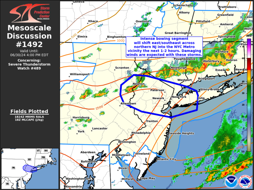
Mesoscale Discussion 1492 NWS Storm Prediction Center Norman OK 0126 PM CDT Sun Jun 30 2024 Areas affected...northern NJ into western Long Island/NYC Metro vicinity Concerning...Severe Thunderstorm Watch 489... Valid 301826Z - 302000Z The severe weather threat for Severe Thunderstorm Watch 489 continues. SUMMARY...An intense bowing segment will move across northern New Jersey into western Long Island and the New York City metro vicinity over the next 1-2 hours. Damaging wind gusts are expected with these storms. DISCUSSION...A cluster of storms has rapidly intensified and developed into a bowing segment near the northern NJ/PA state line this afternoon. This activity will spread east/southeast over the next 1-2 hours into the axis of strong instability oriented over the northern Mid-Atlantic region. These storms have already produced gusts to near 50 kt and areas of wind damage. This activity is likely to continue producing severe/damaging wind gusts as storms spread across northern NJ and the New York City metro vicinity. ..Leitman.. 06/30/2024 ...Please see www.spc.noaa.gov for graphic product... ATTN...WFO...OKX...PHI...BGM... LAT...LON 41297509 41277469 41127395 41047352 40937324 40827318 40507322 40357399 40477485 40667536 40857547 41077546 41297509 |
|
|
Top/All Mesoscale Discussions/Forecast Products/Home |
|