2024-06-29 00:56:05
1719637170
|
|
| Mesoscale Discussion 1470 | |
| < Previous MD | |

|
|
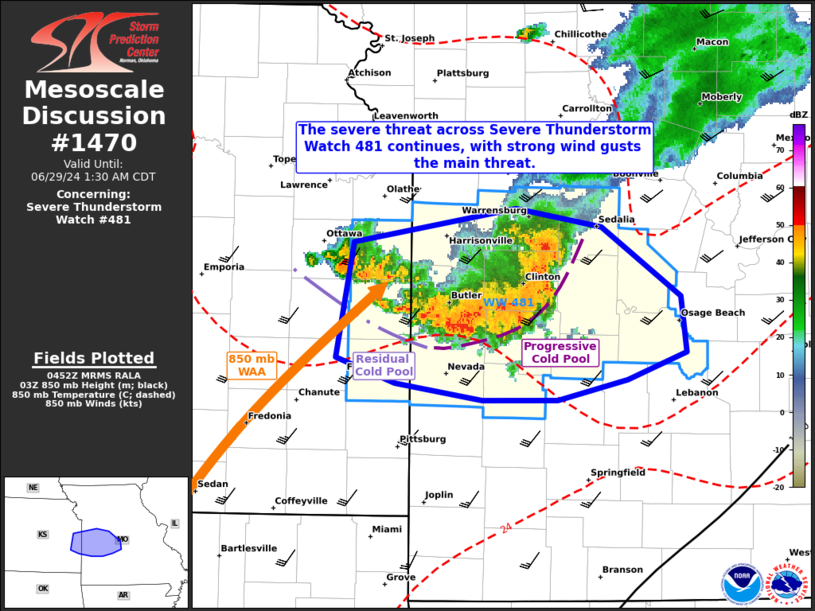
Mesoscale Discussion 1470 NWS Storm Prediction Center Norman OK 1155 PM CDT Fri Jun 28 2024 Areas affected...portions of western Missouri Concerning...Severe Thunderstorm Watch 481... Valid 290455Z - 290630Z The severe weather threat for Severe Thunderstorm Watch 481 continues. SUMMARY...A few additional damaging gusts may accompany ongoing storms over western MO for a few more hours. DISCUSSION...An MCS continues to progress east-southeast across western MO, where a couple of strong/damaging wind gusts have been reported in the past couple of hours. Buoyancy decreases with eastward extent ahead of the MCS, so questions remain regarding how long the severe wind threat may last. Nonetheless, strong 850 mb WAA and over 3000 J/kg of MUCAPE in the immediate vicinity of the MCS suggests that strong wind gusts should remain possible for at least a couple more hours. Meanwhile, the southwesterly LLJ overspreading the remnant cold pool behind the MCS leading line is also supporting back-building convection. If back-building cellular development is strong enough, some hail may be observed as well. ..Squitieri.. 06/29/2024 ...Please see www.spc.noaa.gov for graphic product... ATTN...WFO...SGF...EAX...TOP...ICT... LAT...LON 38619503 38819382 38699319 38299260 37959255 37799299 37689351 37679407 37789472 37929517 38619503 |
|
|
Top/All Mesoscale Discussions/Forecast Products/Home |
|


