|
|
| Mesoscale Discussion 1467 | |
| < Previous MD | |

|
|
   Mesoscale Discussion 1467
   NWS Storm Prediction Center Norman OK
   0814 PM CDT Fri Jun 28 2024

   Areas affected...parts of eastern Colorado...southwestern
   Nebraska...and northwestern Kansas

   Concerning...Severe potential...Watch possible

   Valid 290114Z - 290245Z

   Probability of Watch Issuance...60 percent

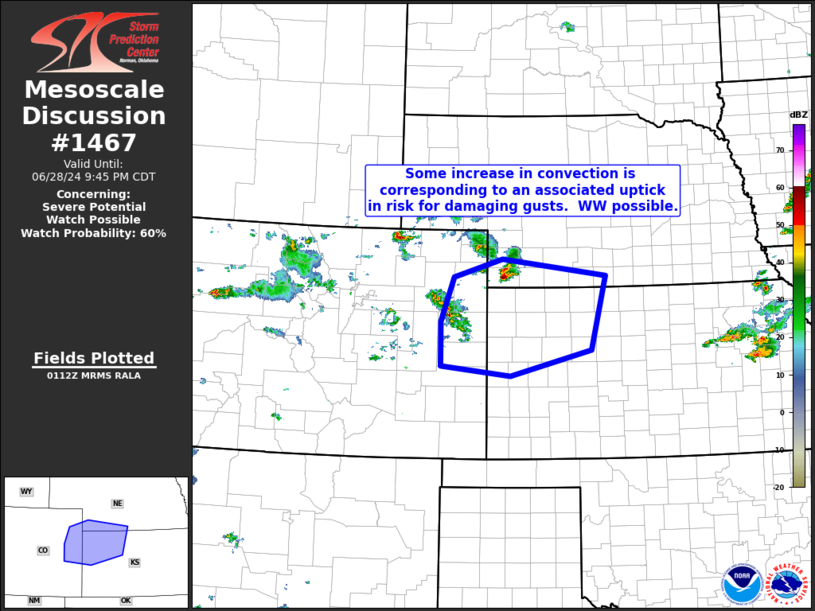
   SUMMARY...Risk for damaging winds appears to be increasing from
   parts of northeastern Colorado and far southwestern Nebraska, across
   northwestern Kansas.  New WW issuance is being considered.

   DISCUSSION...Latest radar loop shows a supercell storm that has
   developed over the past hour now moving across Dundy County
   Nebraska.  Meanwhile, additional storm are initiating west and
   northwest of KITR (Burlington, CO).  This convection is evolving in
   a loosely analogous manner to that depicted by most recent runs of
   the HRRR, which suggest upscale growth of the storms as they move
   eastward into an increasingly unstable airmass with time.

   With this region on the southern fringe of the belt of stronger
   mid-level westerlies, relatively fast, east-southeastward
   progression of the convection is expected.  Risk for gusty/damaging
   winds will likely be enhanced by the deep mixed layer evident across
   the area, where around 40-degree surface temperature/dewpoint
   depression is indicated.  Assuming continued development/upscale
   growth, damaging wind risk may warrant WW issuance.

   ..Goss/Smith.. 06/29/2024

   ...Please see www.spc.noaa.gov for graphic product...

   ATTN...WFO...GID...LBF...DDC...GLD...PUB...BOU...

   LAT...LON   39390308 40180280 40500170 40199935 38909969 38450152
               38610307 39390308
|
|
|
Top/All Mesoscale Discussions/Forecast Products/Home |
|


