|
|
| Mesoscale Discussion 1462 | |
| < Previous MD Next MD > | |

|
|
   Mesoscale Discussion 1462
   NWS Storm Prediction Center Norman OK
   0356 PM CDT Fri Jun 28 2024

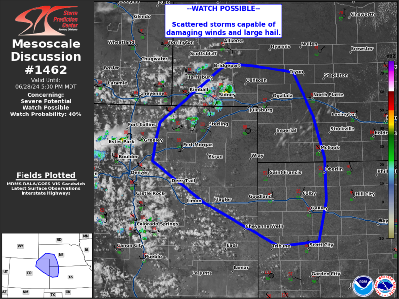
   Areas affected...northeastern Colorado...southwestern
   Nebraska...northwestern Kansas

   Concerning...Severe potential...Watch possible

   Valid 282056Z - 282300Z

   Probability of Watch Issuance...40 percent

   SUMMARY...Isolated to scattered high based storms to develop through
   the afternoon/evening with potential for damaging winds and large
   hail.

   DISCUSSION...Visible satellite shows a region of towering cumulus
   across southeastern Wyoming into the Front Range in Colorado, with a
   few recent attempts at thunderstorm initiation. This largely region
   remains under the influence of mid-level capping, though recent
   radar observations did indicate cells producing lightning briefly in
   the Nebraska panhandle. Trends in cumulus development and several
   initiation attempts indicate mid-level capping may be eroding, with
   potential for additional thunderstorm development within the next
   1-2 hours. Low-level moisture is meager, with high-based elevated
   cells expected that likely need to move into the richer low-level
   moisture and increasing deep layer shear to the east across western
   Nebraska/Kansas before become more organized. Damaging winds and
   large hail will be possible. This area is being monitored for trends
   for watch potential through the afternoon/evening.

   ..Thornton/Gleason.. 06/28/2024

   ...Please see www.spc.noaa.gov for graphic product...

   ATTN...WFO...LBF...DDC...GLD...BOU...CYS...

   LAT...LON   40410440 40690431 41760277 41720214 41590120 40820075
               40080051 39320049 38590067 38510157 39290326 40000446
               40410440
|
|
|
Top/All Mesoscale Discussions/Forecast Products/Home |
|


