|
|
| Mesoscale Discussion 1454 | |
| < Previous MD | |

|
|
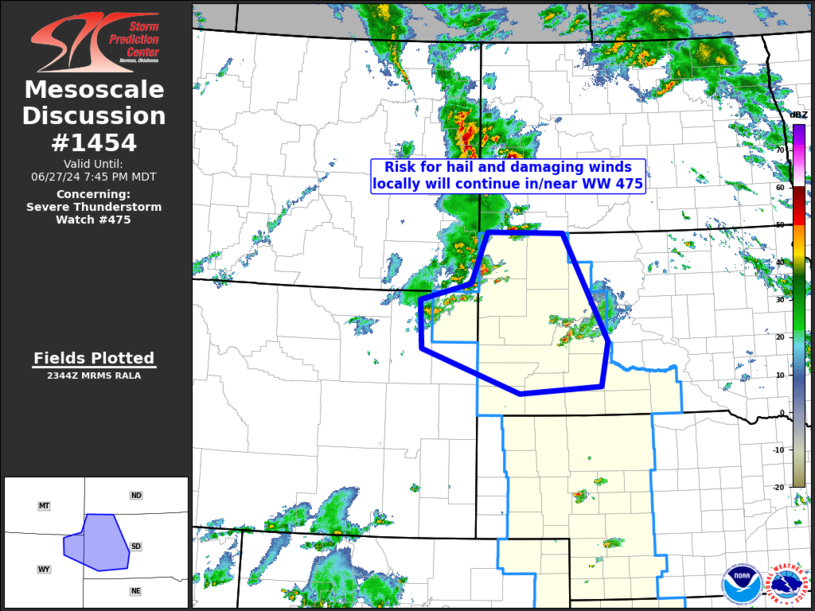
Mesoscale Discussion 1454 NWS Storm Prediction Center Norman OK 0647 PM CDT Thu Jun 27 2024 Areas affected...northeastern Wyoming into western South Dakota Concerning...Severe Thunderstorm Watch 475... Valid 272347Z - 280145Z The severe weather threat for Severe Thunderstorm Watch 475 continues. SUMMARY...Risk for locally damaging gusts and isolated hail should gradually increase across northern portions of WW 475 over the next 1 to 2 hours. DISCUSSION...Latest radar loop shows isolated strong storms east of the Black hills, and a separate/expanding cluster of storms moving eastward out of southeastern Montana and northeastern Wyoming into northern portions of WW 475. With a moist/moderately unstable environment in the vicinity of the warm and cold fronts and the narrow warm sector in between, and veering flow with height providing ample shear for rotating storms, the overall environment remains supportive of large hail and damaging gusts with stronger storms. As such, as the convection spreads eastward into western South Dakota, severe risk should gradually increase. ..Goss.. 06/27/2024 ...Please see www.spc.noaa.gov for graphic product... ATTN...WFO...ABR...BIS...UNR...BYZ... LAT...LON 45130421 45960385 45940212 44190113 43460129 43350310 44060530 44850535 45130421 |
|
|
Top/All Mesoscale Discussions/Forecast Products/Home |
|