|
|
| Mesoscale Discussion 1439 | |
| < Previous MD | |

|
|
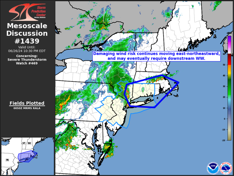
Mesoscale Discussion 1439 NWS Storm Prediction Center Norman OK 0753 PM CDT Wed Jun 26 2024 Areas affected...southeastern New York and southern New England Concerning...Severe Thunderstorm Watch 469... Valid 270053Z - 270230Z The severe weather threat for Severe Thunderstorm Watch 469 continues. SUMMARY...Risk for damaging winds continues -- particularly across northern parts of WW 469. At least some risk should eventually spread into Rhode Island parts of Massachusetts, possibly requiring new WW consideration in the next hour or so. DISCUSSION...Latest radar loop shows a band of strong to severe storms moving east-northeastward into/across southeastern New York including the New York City area at this time. Locally strong/damaging wind gusts remain the primary risk with these storms, which should continue over the next few hours -- moving across Connecticut and Long Island. With the instability axis extending eastward into Rhode Island and portions of Massachusetts near and south of the ongoing/persistent, west-to-east band of storms, at least some risk may extend east of the existing watch in the next couple of hours. This could warrant new WW consideration. ..Goss.. 06/27/2024 ...Please see www.spc.noaa.gov for graphic product... ATTN...WFO...BOX...OKX...ALY... LAT...LON 40687371 41387417 41957400 42527121 42076989 40617180 40687371 |
|
|
Top/All Mesoscale Discussions/Forecast Products/Home |
|