|
|
| Mesoscale Discussion 1438 | |
| < Previous MD Next MD > | |

|
|
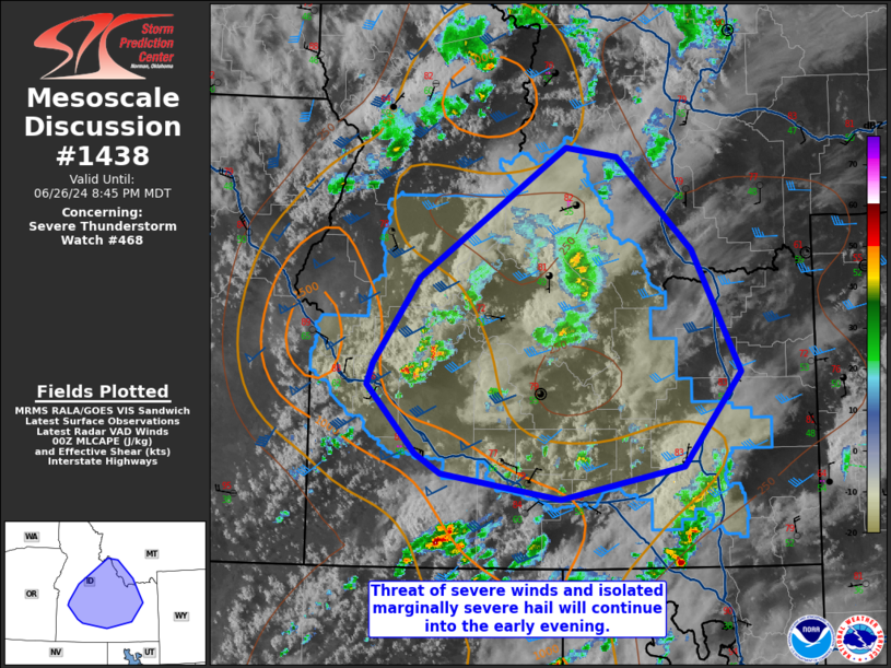
Mesoscale Discussion 1438 NWS Storm Prediction Center Norman OK 0751 PM CDT Wed Jun 26 2024 Areas affected...Southern Idaho into southwest Montana Concerning...Severe Thunderstorm Watch 468... Valid 270051Z - 270245Z The severe weather threat for Severe Thunderstorm Watch 468 continues. SUMMARY...Storms will remain capable of severe winds and marginally severe hail into the evening. The environment becomes less favorable to the east and a weakening trend is expected as storms move into southwest Montana. DISCUSSION...Scattered convection continues across parts of southern Idaho and will eventually progress into southwest Montana. With the continued approach of the upper-level trough this evening, some additional development remains possible in western Idaho. The most intense storms will continue to pose a risk for severe winds as well as marginally severe hail. The hail threat should generally be modulated by somewhat limited buoyancy. With temperatures cooler and the airmass drier into southwest Montana, storms are expected to gradually weaken with eastward extent. ..Wendt.. 06/27/2024 ...Please see www.spc.noaa.gov for graphic product... ATTN...WFO...TFX...PIH...MSO...BOI... LAT...LON 42801547 42971578 43571635 43741628 44491574 45601400 45521339 44721250 43681193 42861260 42591406 42801547 |
|
|
Top/All Mesoscale Discussions/Forecast Products/Home |
|