|
|
| Mesoscale Discussion 1433 | |
| < Previous MD Next MD > | |

|
|
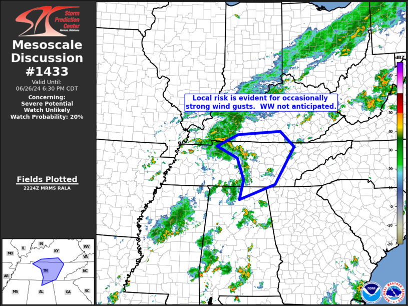
   Mesoscale Discussion 1433
   NWS Storm Prediction Center Norman OK
   0526 PM CDT Wed Jun 26 2024

   Areas affected...middle and eastern Tennessee into southern Kentucky

   Concerning...Severe potential...Watch unlikely

   Valid 262226Z - 262330Z

   Probability of Watch Issuance...20 percent

   SUMMARY...Locally strong wind gusts will be possible as a band of
   storms shifts northeastward across portions of Tennessee and into
   southern Kentucky.  WW issuance may not be needed however, due to
   isolated nature of this risk.

   DISCUSSION...Latest radar loop shows and loosely organized, arcing
   band of storms moving across Middle Tennessee at this time -- in
   line with recent HRRR runs which depicted this band with reasonable
   accuracy.  The storms are moving northeastward through an amply
   unstable environment, but with the flow in the lower to middle
   troposphere somewhat weak (generally less than 25 kt through the mid
   levels), storm organization/intensity should remain generally
   limited.  With the storms producing a 35 kt gust when moving through
   Nashville, per the KBNA observation, this supports the assessment of
   the marginal nature of the risk.  Overall, it appears at this time
   that potential for damaging winds should remain sufficiently
   isolated to preclude WW consideration.

   ..Goss/Smith.. 06/26/2024

   ...Please see www.spc.noaa.gov for graphic product...

   ATTN...WFO...MRX...JKL...FFC...LMK...OHX...HUN...PAH...

   LAT...LON   34528677 35248659 36038689 36478781 36908685 37018493
               36458432 35088518 34528677
|
|
|
Top/All Mesoscale Discussions/Forecast Products/Home |
|