|
|
| Mesoscale Discussion 1407 | |
| < Previous MD | |

|
|
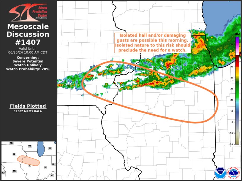
Mesoscale Discussion 1407 NWS Storm Prediction Center Norman OK 0801 AM CDT Tue Jun 25 2024 Areas affected...Far Southeast IA...Central IL Concerning...Severe potential...Watch unlikely Valid 251301Z - 251500Z Probability of Watch Issuance...20 percent SUMMARY...Isolated hail and/or damaging gusts are possible from southeast Iowa into central Illinois over the next few hours. Sporadic/isolated nature to the storms should preclude the need for a watch. DISCUSSION...A large area of warm-air advection initiated thunderstorms continues from southern IA across northern IL. While individual storms within this region are generally moving eastward, the overall area of precipitation has started shifting southeastward, likely in response to the southeastward shift of the low-level jet. Steep mid-level lapse rates support strong elevated buoyancy across the region, as sampled in the 12Z ILX sounding. Moderate vertical shear exists within this region as well, with the 12Z ILX sounding sampling around 35 kt of 0-6 km bulk shear. A sporadic intensification of the cells within this general area is possible, with occasional isolated hail and/or damaging gusts possible. Sporadic/isolated nature to the storms should preclude the need for a watch, but convective trends will be monitored closely. ..Mosier/Edwards.. 06/25/2024 ...Please see www.spc.noaa.gov for graphic product... ATTN...WFO...LOT...ILX...DVN... LAT...LON 41799131 41418913 40838746 40148823 40969205 41799131 |
|
|
Top/All Mesoscale Discussions/Forecast Products/Home |
|