|
|
| Mesoscale Discussion 1397 | |
| < Previous MD | |

|
|
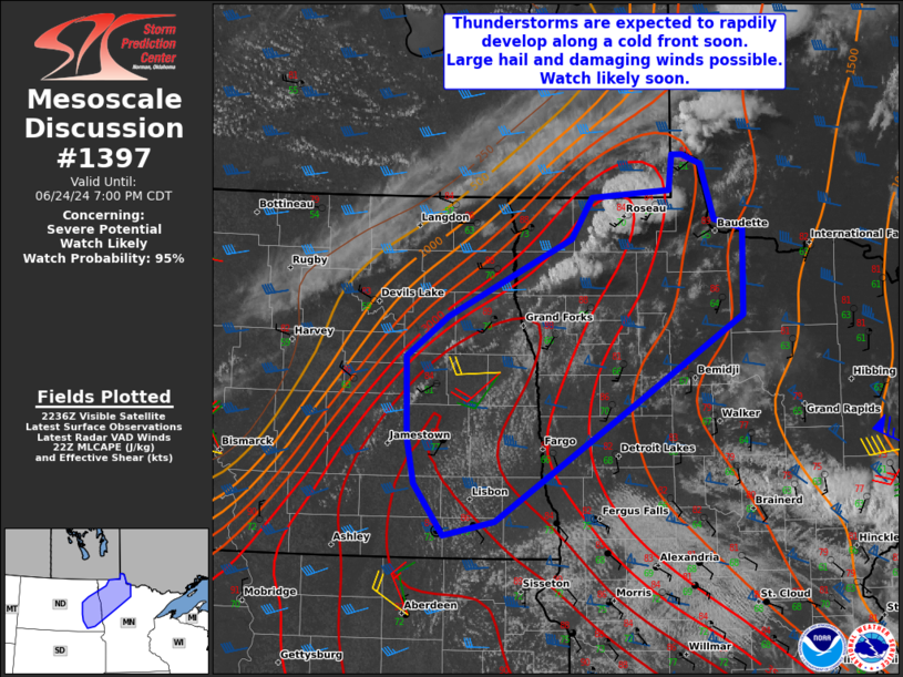
   Mesoscale Discussion 1397
   NWS Storm Prediction Center Norman OK
   0543 PM CDT Mon Jun 24 2024

   Areas affected...Northern Minnesota and eastern/southeastern North
   Dakota

   Concerning...Severe potential...Watch likely

   Valid 242243Z - 250000Z

   CORRECTED FOR GRAPHIC

   Probability of Watch Issuance...95 percent

   SUMMARY...Scattered thunderstorms are expected to develop along a
   cold front through this evening. Large hail up to 1.75-2.50" in
   diameter and damaging wind gusts near 60-70 mph will be possible.

   DISCUSSION...Latest satellite and radar imagery suggest thunderstorm
   development will continue to occur along a cold front extending
   northeast to southwest across portions of far northwestern MN and
   eastern ND. A moderate to extreme instability axis extends along and
   ahead of this cold front, where temperatures have climbed into the
   upper 80s, and dewpoints in the mid 60s to low 70s exist beneath
   steep mid-level lapse rates. VAD profiles and objective analysis
   across this region indicate sufficient deep layer effective shear
   (40-55 kt) is already in place. Storm organization and a few
   supercells appear likely along this axis through this evening. Large
   hail will initially be possible with the more discrete thunderstorms
   that develop, before cell mergers occur with an accompanying
   damaging wind threat later this evening as instability wanes. A
   severe thunderstorm watch will be needed soon.

   ..Barnes/Gleason.. 06/24/2024

   ...Please see www.spc.noaa.gov for graphic product...

   ATTN...WFO...DLH...FGF...BIS...

   LAT...LON   49289478 49359501 49359514 49069518 48999616 48659642
               47999797 47659849 46969846 46569837 46129801 46249736
               47259559 48009426 48739425 48819460 49289478
|
|
|
Top/All Mesoscale Discussions/Forecast Products/Home |
|