|
|
| Mesoscale Discussion 1393 | |
| < Previous MD | |

|
|
Mesoscale Discussion 1393
NWS Storm Prediction Center Norman OK
1140 AM CDT Mon Jun 24 2024
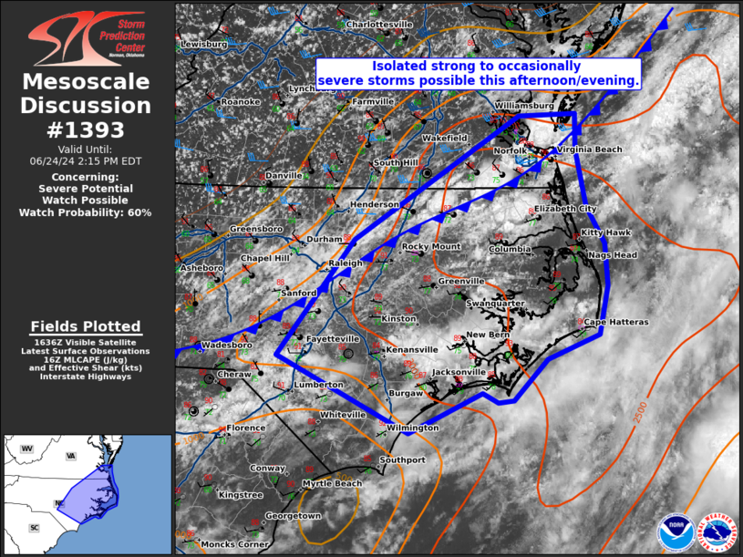
Areas affected...Eastern North Carolina and far southeast Virginia.
Concerning...Severe potential...Watch possible
Valid 241640Z - 241815Z
Probability of Watch Issuance...60 percent
SUMMARY...Strong to severe thunderstorms are possible this
afternoon/evening across southeast Virginia and eastern North
Carolina.
DISCUSSION...Storms have started to develop across southeast
Virginia and northeast North Carolina in a hot/unstable airmass
featuring temperatures in the low 90s and dewpoints in the 70s. This
has yielded 2500 J/kg MLCAPE and an uncapped atmosphere. Initial
storms have shown occasional supercellular characteristics with some
multicell clustering also apparent. This storm organization can
likely be attributed to the 30-35 knot westerly flow aloft apparent
on the AKQ VWP.
Expect additional storms to form along and ahead of the cold front
as it sags south across eastern North Carolina. The modest shear
combined with strong instability will permit a continued damaging
wind threat through the afternoon and evening. A severe thunderstorm
watch may be needed to cover this threat.
..Bentley/Hart.. 06/24/2024
...Please see www.spc.noaa.gov for graphic product...
ATTN...WFO...AKQ...MHX...RAH...ILM...
LAT...LON 34957919 36057830 37237640 37257573 36907573 36367562
36017540 35617538 35157548 34927608 34547647 34517665
34617683 34227768 34957919
|
|
|
Top/All Mesoscale Discussions/Forecast Products/Home |
|