|
|
| Mesoscale Discussion 1368 | |
| < Previous MD | |

|
|
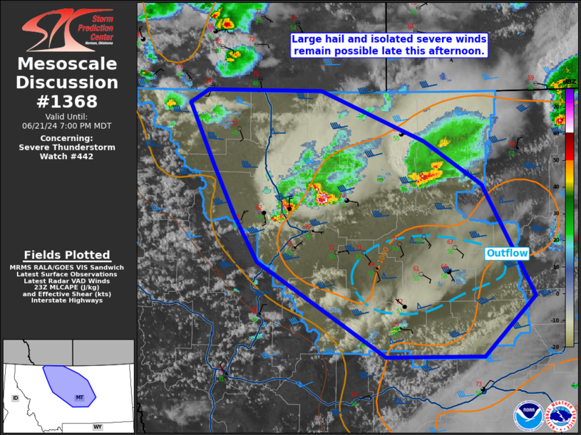
Mesoscale Discussion 1368 NWS Storm Prediction Center Norman OK 0627 PM CDT Fri Jun 21 2024 Areas affected...Western into central Montana Concerning...Severe Thunderstorm Watch 442... Valid 212327Z - 220100Z The severe weather threat for Severe Thunderstorm Watch 442 continues. SUMMARY...The strongest convection will continue southeastward this evening. Additional development may occur. Large hail and isolated severe winds are the main hazards. DISCUSSION...A few widely scattered supercells are moving slowly southeastward into parts of central Montana. This motion is generally expected to continue into the evening, as this is where the moisture axis is situated. However, some early convection has left some outflow (cooler/modestly drier) that is evident in surface observations. It is unclear how this will impact the ongoing strong/severe storms as they encounter this mesoscale environment. Additional storms may develop within the terrain or perhaps along the southern edge of the outflow. It also appears possible that a storm or two could move southeastward out of Alberta. In general, large hail (conditionally up to 2 inches with a mature supercell) and isolated strong/severe gusts are the main threats into the evening. ..Wendt.. 06/21/2024 ...Please see www.spc.noaa.gov for graphic product... ATTN...WFO...BYZ...GGW...TFX... LAT...LON 47651240 48211276 48861316 49011287 49011105 48460940 47990849 46790767 46150848 46141001 47161204 47651240 |
|
|
Top/All Mesoscale Discussions/Forecast Products/Home |
|