|
|
| Mesoscale Discussion 1363 | |
| < Previous MD Next MD > | |

|
|
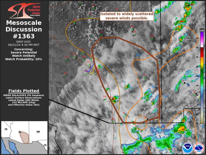
   Mesoscale Discussion 1363
   NWS Storm Prediction Center Norman OK
   0453 PM CDT Fri Jun 21 2024

   Areas affected...Southeastern Arizona

   Concerning...Severe potential...Watch unlikely

   Valid 212153Z - 212330Z

   Probability of Watch Issuance...20 percent

   SUMMARY...Isolated to widely scattered strong to severe winds are
   possible in parts of southeastern Arizona.

   DISCUSSION...A tropical moisture plume within the Southwest (PWAT
   values greater than 1 in. per GPS TPW in southeast Arizona)
   continues to foster isolated to widely scattered thunderstorms.
   Shear is relatively weak per regional VAD data, and strong heating
   has been somewhat muted by high-level cloud cover. Even so,
   temperature-dewpoint spreads are sufficient to support a few strong
   to severe wind gusts. With higher than average moisture content,
   enough storm coverage may exist for a cluster to two to develop.
   Should this occur, a locally greater wind threat would exist with
   those clusters. Storm coverage into the western portions of the
   Phoenix metro is fairly uncertain, but outflow could try and push
   westward into a much more well-mixed boundary layer (temperatures in
   excess of 110 F) and produce strong winds.

   ..Wendt/Edwards.. 06/21/2024

   ...Please see www.spc.noaa.gov for graphic product...

   ATTN...WFO...TWC...FGZ...PSR...

   LAT...LON   31641073 32521129 33181163 33771178 34111143 34141078
               33800978 33380920 32300911 31530913 31330986 31351053
               31641073
|
|
|
Top/All Mesoscale Discussions/Forecast Products/Home |
|
Source link