|
|
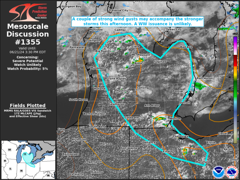
| Mesoscale Discussion 1355 | |
| < Previous MD | |

|
|
   Mesoscale Discussion 1355
   NWS Storm Prediction Center Norman OK
   1257 PM CDT Fri Jun 21 2024

   Areas affected...portions of Lower Michigan into northern Ohio

   Concerning...Severe potential...Watch unlikely

   Valid 211757Z - 211930Z

   Probability of Watch Issuance...5 percent

   SUMMARY...Thunderstorms should gradually increase in coverage and
   intensity through the afternoon, with the strongest storms
   accompanied by a couple of potentially damaging wind gusts. The
   severe threat should remain isolated and a WW issuance is not
   expected.

   DISCUSSION...Strong surface heating and low 70s F dewpoints beneath
   an upper-ridging environment is supporting convective initiation
   given weak MLCINH. Tropospheric lapse rates are not particularly
   steep, with MLCAPE constrained to around 1500 J/kg via tall and thin
   profiles. Vertical wind shear is weak, so mainly pulse cellular
   storm modes are expected. The stronger storms may produce strong
   wind gusts, though severe gusts should be isolated, precluding a WW
   issuance.

   ..Squitieri/Hart.. 06/21/2024

   ...Please see www.spc.noaa.gov for graphic product...

   ATTN...WFO...CLE...DTX...APX...IWX...GRR...

   LAT...LON   44228478 43808422 43578369 43898327 44018303 44018284
               43708261 43058253 42618273 42098322 41818330 41588303
               41378249 41048205 40718217 40938329 41598458 41848484
               42538551 43558609 44118555 44228478
|
|
|
Top/All Mesoscale Discussions/Forecast Products/Home |
|