|
|
| Mesoscale Discussion 1346 | |
| < Previous MD | |

|
|
Mesoscale Discussion 1346
NWS Storm Prediction Center Norman OK
0442 PM CDT Thu Jun 20 2024
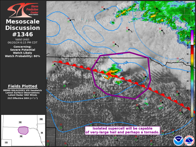
Areas affected...Sandhills Vicinity
Concerning...Severe potential...Watch likely
Valid 202142Z - 202315Z
Probability of Watch Issuance...80 percent
SUMMARY...A watch is likely for parts of western/central Nebraska by
this evening. Storm coverage with eastern extent may remain quite
isolated in the short term, but additional activity will move in
from the west.
DISCUSSION...Despite rising mid-level heights downstream of a
digging trough in the lower Colorado River Valley, an isolated
supercell has developed along a warm front in the Sandhills. This
appears to be aided be weak warm advection and perhaps a weak
shortwave perturbation moving through Nebraska. Sufficient mid-level
lapse rates and the supercellular mode should promote a risk of
large to potentially very-large hail with this storm. Enhanced
low-level SRH near the boundary would also suggest that a low-end
tornado threat would exist as well. Visible satellite and KLNX radar
suggest other updrafts trying to develop in the nearby vicinity.
Some of these updrafts have already merged with the more mature
supercell. This activity could further increase tornado potential on
the storm scale.
The primary uncertainty in this scenario is storm coverage, given
the rising heights alluded to earlier. However, this storm will be
capable of all severe hazards. Furthermore, storms that are expected
to congeal in the Nebraska Panhandle may progress into these areas
as the low-level jet strengthens this evening.
..Wendt/Edwards.. 06/20/2024
...Please see www.spc.noaa.gov for graphic product...
ATTN...WFO...FSD...LBF...UNR...
LAT...LON 42369849 42139860 41849909 41959999 41980017 42220059
42670075 43050042 43169929 42999857 42369849
|
|
|
Top/All Mesoscale Discussions/Forecast Products/Home |
|