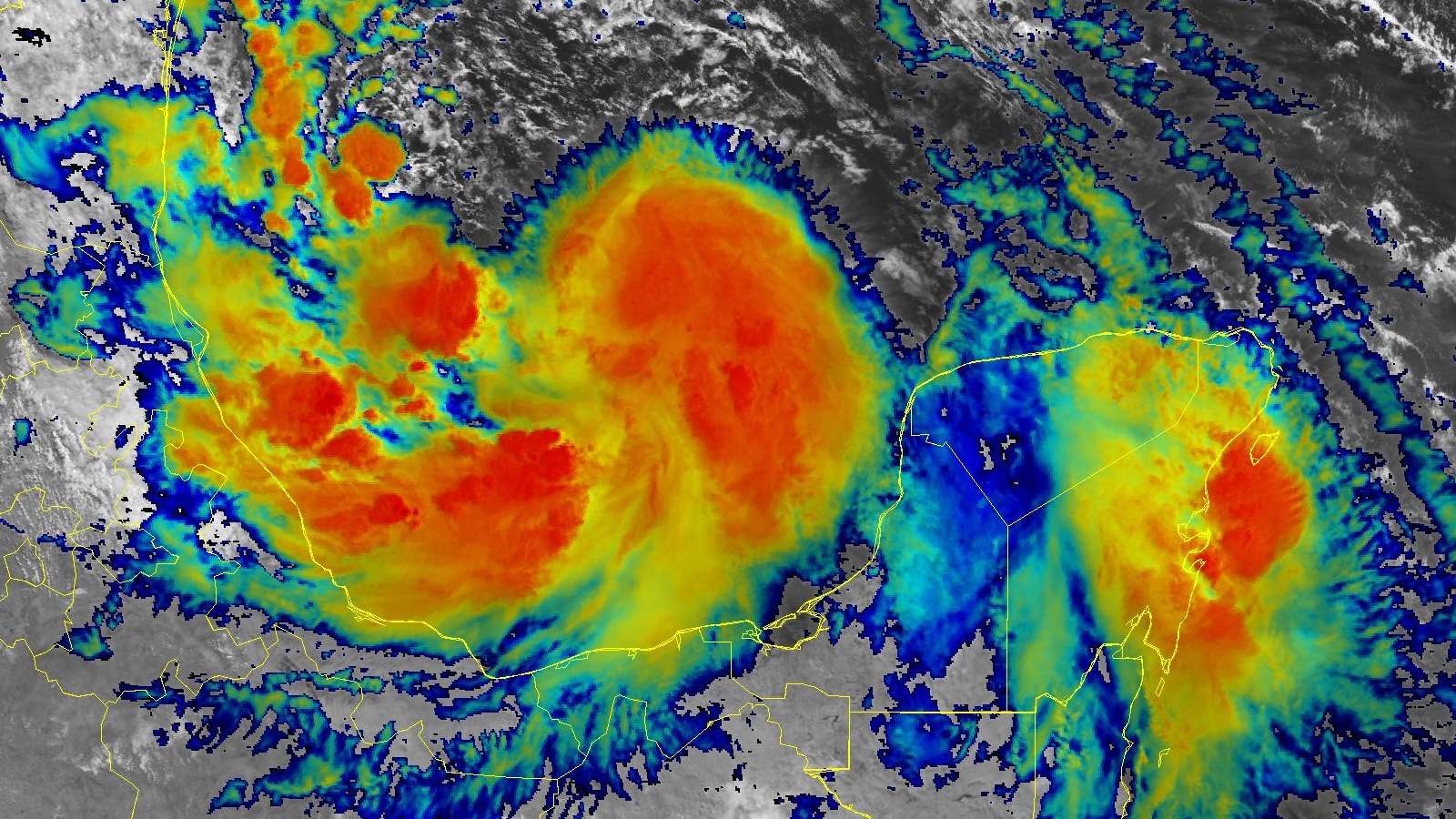
The first tropical storm of what’s expected to be a rip-roaring 2024 Atlantic season – Alberto – was hurtling toward an expected landfall in northeast Mexico after being officially named at 11 a.m. EDT Wednesday, June 19. Tropical storm warnings were in effect for most of the west coast of the Gulf of Mexico, extending from Tecolutla, Mexico, well north to San Luis Pass, Texas.
Even before the storm was named, Alberto’s huge, lopsided wind field drove a large storm surge of 3-4 feet to the central and upper Texas coast during the high tide cycle on Wednesday morning. Major coastal flooding occurred from Freeport to Galveston, including Surfside Beach (see video below). The National Hurricane Center (NHC) had warned for days that Alberto’s unusual northward extent would bring more surge to Texas than one might expect from a weak tropical storm so far to the south.
At 11 a.m. Wednesday, Alberto was centered about 185 miles east of Tampico, Mexico, moving west at 9 mph with a central pressure of 995 mb and top sustained winds at minimal tropical-storm strength of 40 mph. Reflecting Alberto’s north-loaded structure, tropical storm winds extended up to 360 nautical miles (414 miles) to the north but were nearly absent to the south.
Satellite images on Wednesday showed Alberto was a large system, filling up the entire Bay of Campeche, with heavy thunderstorms building and organizing near the center of circulation. Heavy rains from the system were already affecting a large swath of Mexico’s Gulf of Mexico coast. Radar-estimated rainfall amounts of 2-4 inches had fallen along the central Texas coast near Galveston in the 24 hours ending at 11 a.m. EDT Wednesday. The moisture-laden airmass was apparent in the Wednesday morning upper-air data from Corpus Christi and Brownsville, where a precipitable water value of 2.72” was reported – the most moisture ever recorded above Corpus Christi for any date between November and June. Brownsville also set a November-to-June record with 2.75”.


Forecast for Alberto
The huge ridge of high pressure that’s been driving a notable heat wave over the U.S. Midwest and East will also help keep Alberto from recurving poleward. Instead, the storm is predicted to continue westward and make landfall as a tropical storm near or just north of Tampico, Mexico, early Thursday morning. Alberto should weaken quickly after landfall over the mountainous terrain just inland.
The primary threat will be heavy rains extending well inland across northeast Mexico and far south Texas. Although drought has been a major issue across this region, the rains from Alberto may fall far too quickly for the parched ground to absorb. Widespread amounts of 4 to 8 inches are expected, with pockets of up to 20 inches possible in the higher terrain of Coahuila, Nuevo Leon, and Tamaulipas states. Heavy rains from Alberto are already being blamed for 11 deaths in El Salvador and three in Guatemala.
Further north, Alberto will continue to make its presence felt in Texas with gusty winds and continued coastal storm surge of 2-4 feet as far north as the Galveston area and 1-3 feet into southwest Louisiana. Given Alberto’s unusually sprawling structure, the Texas surge may end up actually exceeding the surge just north of Alberto’s landfall location in Mexico, which is predicted to be 1-3 feet.
Alberto’s large size and its limited remaining time over water will likely prevent much strengthening, despite favorable conditions overall: sea surface temperatures of 30 degrees Celsius (86°F), moderate wind shear of 10-20 knots, and a moist atmosphere with a midlevel relative humidity of 75%.
Bay of Campeche déjà vu?
The GFS and European models and their ensembles are predicting that another disturbance will develop in the southern Gulf of Mexico’s Bay of Campeche on Saturday, and then potentially develop into a tropical storm that would bring additional heavy rains to South Texas and northeastern Mexico on Sunday and Monday. This system is currently depicted as being weaker than Alberto, and it would be less likely to cause the far-flung marine impacts in Texas being produced by Alberto. However, it might cause greater flooding than would ordinarily be the case, since its rains would be falling on soils already saturated from Alberto. In its Tropical Weather Outlook issued at 8 a.m. EDT Wednesday, NHC gave this future system 2-day and 7-day odds of development of 0% and 30%, respectively.
Also being monitored is a disturbance enmeshed in an upper low a few hundred miles east of the Bahamas. Satellite imagery shows some signs of gradual organization, and a reconnaissance flight has been slated for Thursday morning to investigate it. As of early Wednesday, the European and GFS forecast model ensembles continued to offer little support, and the latest NHC outlook gave this system 10% and 20% odds of development in the 2- and 7-day periods, respectively. Regardless of any development, the disturbance and the deep easterly flow in which it’s embedded could bring enhanced rains to parts of Southeast U.S. on Thursday night through Friday. Rip currents will be a significant hazard into the weekend on some beaches, particularly in South Carolina and Georgia.
The next two names on the 2024 Atlantic list after Alberto are Beryl and Chris.
Source link


