|
|
| Mesoscale Discussion 1309 | |
| < Previous MD | |

|
|
   Mesoscale Discussion 1309
   NWS Storm Prediction Center Norman OK
   0623 PM CDT Mon Jun 17 2024

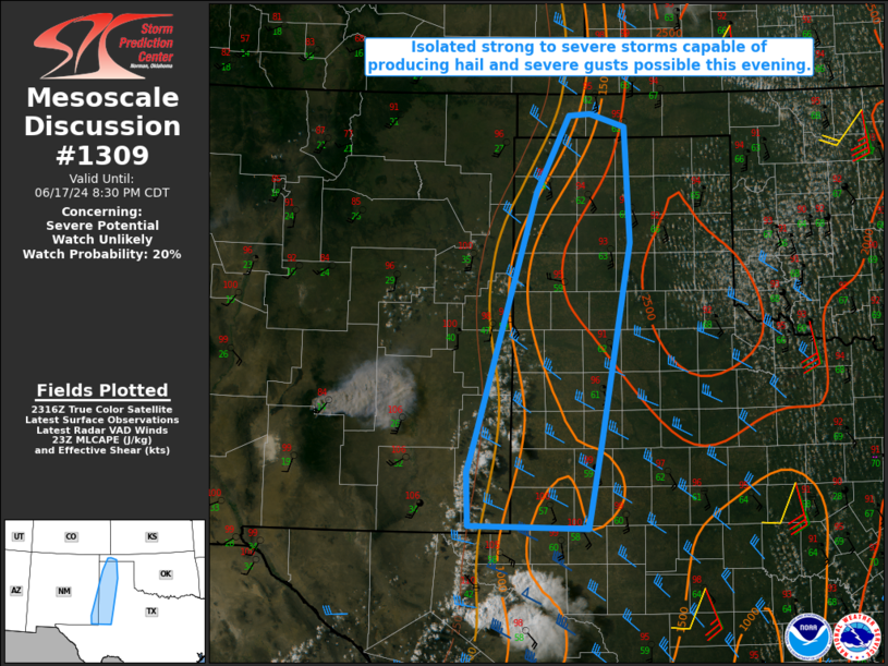
   Areas affected...Parts of the OK/TX Panhandles into the Permian
   Basin vicinity

   Concerning...Severe potential...Watch unlikely

   Valid 172323Z - 180130Z

   Probability of Watch Issuance...20 percent

   SUMMARY...Isolated strong to severe storms are possible this
   evening, with a threat of hail and localized severe gusts.

   DISCUSSION...Strong heating has resulted in moderate destabilization
   along/east of a diffuse dryline from the OK/TX Panhandles southward
   into parts of the Permian Basin and southeast NM. A weak midlevel
   shortwave trough moving across eastern NM may aid in development of
   isolated thunderstorms this evening. Midlevel flow is rather modest,
   but sufficient veering with height is supporting effective shear of
   30-35 kt across the region, and a couple organized cells/clusters
   could evolve with time. Rather deep, well-mixed boundary layers and
   moderate low-level flow will support isolated severe gusts with the
   stronger storms, with sufficient buoyancy for some hail potential as
   well. Watch issuance is currently considered unlikely, with coverage
   of the severe threat expected to remain rather isolated.

   ..Dean/Edwards.. 06/17/2024

   ...Please see www.spc.noaa.gov for graphic product...

   ATTN...WFO...LUB...AMA...MAF...ABQ...

   LAT...LON   33060355 35870272 36750226 36770197 36610149 35290142
               33020182 32040201 32070363 32690366 33060355
|
|
|
Top/All Mesoscale Discussions/Forecast Products/Home |
|


