|
|
| Mesoscale Discussion 1269 | |
| < Previous MD | |

|
|
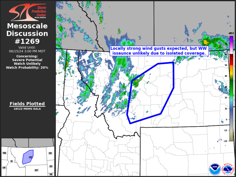
   Mesoscale Discussion 1269
   NWS Storm Prediction Center Norman OK
   0155 PM CDT Sat Jun 15 2024

   Areas affected...central and western Montana

   Concerning...Severe potential...Watch unlikely

   Valid 151855Z - 152100Z

   Probability of Watch Issuance...20 percent

   SUMMARY...Locally strong gusts are expected as storms continue to
   develop across western and central Montana, but isolated nature of
   the risk suggests WW issuance remains unlikely.

   DISCUSSION...Latest visible satellite and radar loops show
   convection developing across the higher terrain of western Montana,
   with a very weakly unstable airmass.  While the meager instability
   should limit convective intensity, flow aloft remains quite strong,
   which could at times augment updraft longevity.  This, combined with
   a rather deep/dry mixed layer that continues to evolve as the
   boundary layer warms, suggests potential for a few strong gusts --
   aided by sub-cloud evaporation.  CAMs continue to hint at potential
   for some upscale growth -- a scenario that bears watching for later
   today/farther east.  In the short term however, weaker instability
   with eastward extent into central Montana should limit potential for
   more widespread severe wind.

   ..Goss/Gleason.. 06/15/2024

   ...Please see www.spc.noaa.gov for graphic product...

   ATTN...WFO...BYZ...GGW...TFX...

   LAT...LON   45201183 45661208 47491174 48400970 48450845 47100848
               45730950 45201183
|
|
|
Top/All Mesoscale Discussions/Forecast Products/Home |
|