|
|
| Mesoscale Discussion 1252 | |
| < Previous MD Next MD > | |

|
|
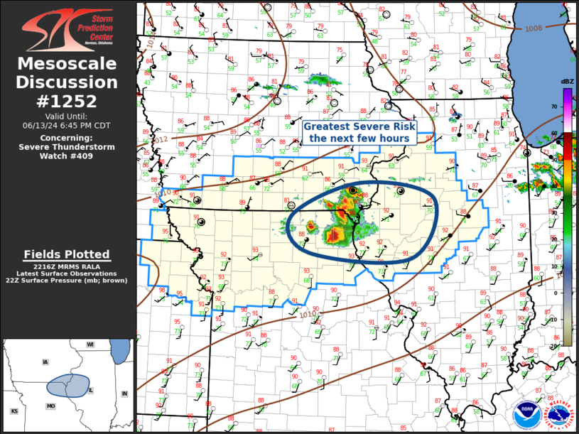
Mesoscale Discussion 1252 NWS Storm Prediction Center Norman OK 0518 PM CDT Thu Jun 13 2024 Areas affected...Parts of the Midwest Concerning...Severe Thunderstorm Watch 409... Valid 132218Z - 132345Z The severe weather threat for Severe Thunderstorm Watch 409 continues. SUMMARY...Cluster of severe thunderstorms will propagate across southeast Iowa/northeast Missouri into western Illinois. Very large hail, possibly in excess of 2 inches, can be expected with this activity. DISCUSSION...An expanding cluster of severe thunderstorms has developed over southeast IA/northeast MO early this evening. This activity is evolving along a wind shift that extends from western IL/southeast IA/northwest MO. Latest diagnostic data suggests this convection is evolving within an air mass characterized by 3000 J/kg MLCAPE and adequately sheared for sustained rotating updrafts. Numerous reports of hail in excess of 2 inches have been received with this convection. With time this cluster should grow upscale and an MCS may ultimately evolve. Severe winds may become more common if/when the MCS matures. Subsequent movement is expected across western into central IL. ..Darrow.. 06/13/2024 ...Please see www.spc.noaa.gov for graphic product... ATTN...WFO...ILX...LSX...DVN...DMX...EAX... LAT...LON 40808968 39769020 39869249 40509289 41089134 40808968 |
|
|
Top/All Mesoscale Discussions/Forecast Products/Home |
|


