|
|
| Mesoscale Discussion 1223 | |
| < Previous MD | |

|
|
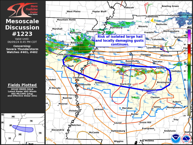
Mesoscale Discussion 1223 NWS Storm Prediction Center Norman OK 0719 PM CDT Sun Jun 09 2024 Areas affected...Portions of northern AL...northern MS...and southeastern AR Concerning...Severe Thunderstorm Watch 401...402... Valid 100019Z - 100145Z The severe weather threat for Severe Thunderstorm Watch 401, 402 continues. SUMMARY...The risk of isolated large hail and locally damaging gusts continues across parts of Severe Thunderstorm Watches 401 and 402. DISCUSSION...Isolated to widely scattered thunderstorms are ongoing from parts of southeastern AR eastward into northern AL -- generally focused along a sagging frontal boundary. While a warm/moist boundary layer and around 30-35 kt of unidirectional westerly deep-layer shear (per regional VWP) continue to support organized/transient supercell structures and small clusters, there has been a tendency for storms to be undercut by the southward-sagging boundary and outflow -- given the westerly storm motions and shear. This suggests that isolated large hail (up to 1.5 inches) will be the primary threat with any organized/sustained storms, though locally damaging gusts are also possible. ..Weinman.. 06/10/2024 ...Please see www.spc.noaa.gov for graphic product... ATTN...WFO...BMX...HUN...MEG...JAN...LZK... LAT...LON 34139144 34369187 34599194 34809169 34739093 34478959 34308735 34268629 34118606 33738601 33468610 33258654 33218725 33478895 33739021 34139144 |
|
|
Top/All Mesoscale Discussions/Forecast Products/Home |
|


