|
|
| Mesoscale Discussion 1136 | |
| < Previous MD | |

|
|
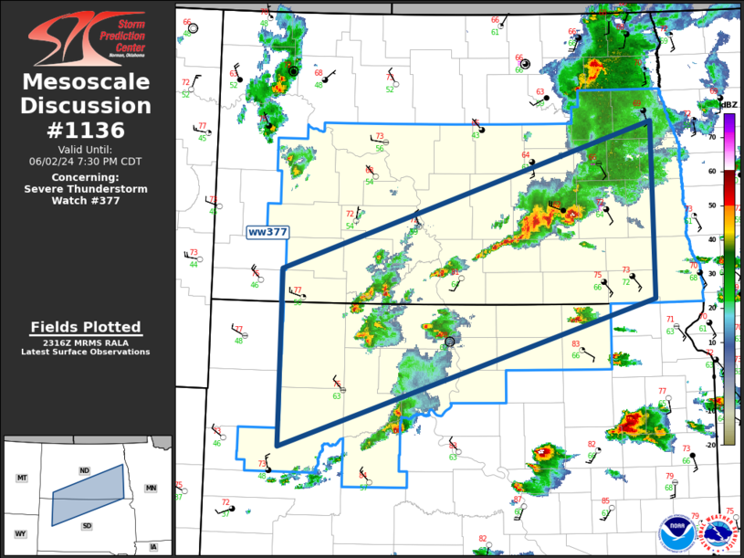
Mesoscale Discussion 1136 NWS Storm Prediction Center Norman OK 0618 PM CDT Sun Jun 02 2024 Areas affected...Northern Plains Concerning...Severe Thunderstorm Watch 377... Valid 022318Z - 030030Z CORRECTED FOR WRONG WATCH NUMBER The severe weather threat for Severe Thunderstorm Watch 377 continues. SUMMARY...Severe threat will gradually shift southeast across ww0377. DISCUSSION...Low-amplitude, positive-tilt short-wave trough is currently ejecting northeast across southern MB/ND. Trailing influence of this feature appears to be aiding strong/severe convection that is approaching the Red River region, while a secondary short wave is likely aiding upstream activity that arcs across the western Dakotas. With time, surface front is expected to advance southeast across ww377, and this boundary will serve as the focus for ongoing/renewed development. Latest radar data suggests hail is approaching severe levels in many of the most robust updrafts. This trend should continue along with the threat for gusty winds. ..Darrow.. 06/02/2024 ...Please see www.spc.noaa.gov for graphic product... ATTN...WFO...FGF...ABR...BIS...UNR... LAT...LON 46300296 47869730 45989729 44400297 46300296 |
|
|
Top/All Mesoscale Discussions/Forecast Products/Home |
|
Source link