|
|
| Mesoscale Discussion 1112 | |
| < Previous MD | |

|
|
   Mesoscale Discussion 1112
   NWS Storm Prediction Center Norman OK
   0237 PM CDT Sat Jun 01 2024

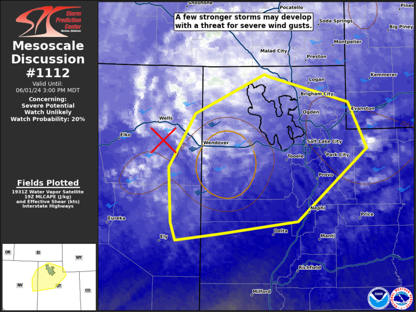
   Areas affected...parts of northern Utah.

   Concerning...Severe potential...Watch unlikely

   Valid 011937Z - 012100Z

   Probability of Watch Issuance...20 percent

   SUMMARY...A few stronger storms may develop with an increasing
   threat for severe wind gusts this afternoon/evening.

   DISCUSSION...Temperatures have warmed into the upper 70s to low 80s
   with dewpoints in the 30s and 40s across northern Utah. This has
   resulted instability around 250-500 J/kg MLCAPE with some additional
   increase possible as heating continues. A well-defined  mid-level
   shortwave trough (on 6.2u water vapor imagery) is moving out of
   eastern Nevada which should provide sufficient lift for scattered
   thunderstorm development this afternoon. These relatively quick
   moving storms with an inverted-V thermodynamic profile will support
   a threat for severe wind gusts this afternoon and early evening.
   Once the boundary layer starts to cool this evening, expect the
   severe wind threat to wane.

   ..Bentley/Smith.. 06/01/2024

   ...Please see www.spc.noaa.gov for graphic product...

   ATTN...WFO...SLC...LKN...

   LAT...LON   39531466 40391471 41241417 41871274 41831262 41431101
               40701063 39551205 39351362 39251457 39531466
|
|
|
Top/All Mesoscale Discussions/Forecast Products/Home |
|


