|
|
| Mesoscale Discussion 1105 | |
| < Previous MD | |

|
|
   Mesoscale Discussion 1105
   NWS Storm Prediction Center Norman OK
   0902 AM CDT Sat Jun 01 2024

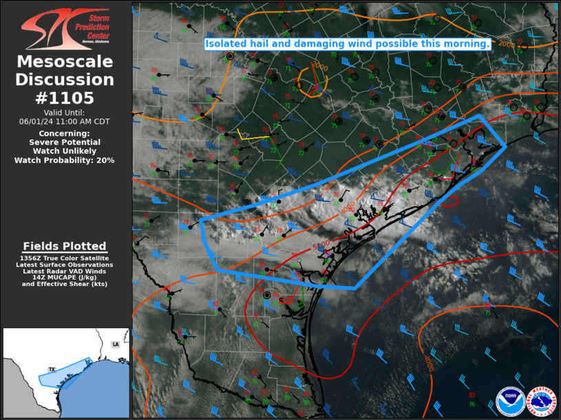
   Areas affected...South-central TX into the middle/upper TX coast
   vicinity

   Concerning...Severe potential...Watch unlikely

   Valid 011402Z - 011600Z

   Probability of Watch Issuance...20 percent

   SUMMARY...Isolated large hail and damaging wind possible this
   morning.

   DISCUSSION...Storms have intensified this morning from south-central
   TX into the middle TX coast vicinity, mainly to the north of a weak
   surface boundary draped across the region. Very rich low-level
   moisture beneath steep midlevel lapse rates is supporting strong
   buoyancy across the region, and additional elevated storm
   development/intensification will be possible through mid morning.

   Relatively strong mid/upper-level west-northwesterlies are
   supporting sufficient effective shear (40+ kt) for some storm
   organization, including the potential for a supercell or two. Severe
   storm longevity and coverage remain somewhat uncertain through the
   morning, but isolated hail and localized damaging gusts will be
   possible. If trends support an uptick in severe-storm coverage, then
   watch issuance will be considered.

   ..Dean/Smith.. 06/01/2024

   ...Please see www.spc.noaa.gov for graphic product...

   ATTN...WFO...HGX...CRP...EWX...

   LAT...LON   28759826 29049730 29639566 29979476 29539437 29219474
               29039509 28799542 27659669 27679728 27879879 28249899
               28559905 28759826
|
|
|
Top/All Mesoscale Discussions/Forecast Products/Home |
|
Source link


