|
|
| Mesoscale Discussion 1091 | |
| < Previous MD | |

|
|
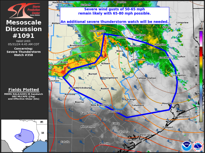
Mesoscale Discussion 1091 NWS Storm Prediction Center Norman OK 0320 AM CDT Fri May 31 2024 Areas affected...Central to southeast TX Concerning...Severe Thunderstorm Watch 358... Valid 310820Z - 310945Z The severe weather threat for Severe Thunderstorm Watch 358 continues. SUMMARY...A severe wind threat will persist through daybreak with a bowing QLCS and expand into parts of east-central to southeast Texas. An additional severe thunderstorm watch is expected to parts of the Southeast Texas Coastal Plain. Wind gusts of 50-65 mph will remain likely with localized enhancements of 65-80 mph possible. DISCUSSION...A bowing QLCS has accelerated in forward motion across central TX to around 45-50 kts, with measured wind gusts to 62 mph reported thus far. This eastward surge along the northeast portion of the QLCS will likely persist into east-central TX before it impinges on remnant stratiform rain and greater low-level stability over northeast TX. A secondary bowing surge may eventually emanate out of the trailing southwest portion of the QLCS. Persistent deep convection here is about to impinge on the warmer/more moist boundary-layer west of Austin. This may similarly begin to intensify and surge southeastward through the greater Austin area and eventually towards the Houston Metro area. With favorable low-level inflow and pronounced enhancement to rearward flow based on time-series of DYX VWP data, it is appears likely that an organized QLCS will continue towards the southeast TX Coastal Plain through daybreak. ..Grams/Thompson.. 05/31/2024 ...Please see www.spc.noaa.gov for graphic product... ATTN...WFO...SHV...HGX...FWD...EWX...SJT... LAT...LON 32199761 32139718 32049667 31899597 31599518 30999481 30529474 30209479 29609506 29349671 29949799 30239870 30679920 30969887 31209796 31469773 32199761 |
|
|
Top/All Mesoscale Discussions/Forecast Products/Home |
|


