|
|
| Mesoscale Discussion 1062 | |
| < Previous MD | |

|
|
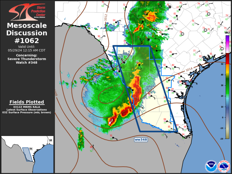
Mesoscale Discussion 1062 NWS Storm Prediction Center Norman OK 1014 PM CDT Tue May 28 2024 Areas affected...Deep South Texas Concerning...Severe Thunderstorm Watch 348... Valid 290314Z - 290515Z The severe weather threat for Severe Thunderstorm Watch 348 continues. SUMMARY...Severe threat will spread across central into southern portions of ww0348 over the next several hours. DISCUSSION...Weak short-wave trough is progressing across the southern High Plains and this feature is now turning southeast within broader northwesterly flow. Strong surface heating and orographic influences allowed multiple thunderstorm clusters to evolve across southwest TX/northeast Mexico late this afternoon/early evening. This activity has grown upscale and is now a mature MCS that is propagating toward deep south TX. Leading edge of this activity is surging through Webb/Zapata Counties along the instability axis characterized by MLCAPE around 4000 J/kg. While 00z soundings from CRP/BRO where both capped this evening, it appears adequate northwesterly mid-level flow exists at this latitude for this complex to advance a considerable more distance before weakening. Damaging winds and hail remain likely with this MCS. ..Darrow.. 05/29/2024 ...Please see www.spc.noaa.gov for graphic product... ATTN...WFO...CRP...EWX...BRO... LAT...LON 26089917 29100027 29119878 26089772 26089917 |
|
|
Top/All Mesoscale Discussions/Forecast Products/Home |
|


