|
|
| Mesoscale Discussion 910 | |
| < Previous MD | |

|
|
   Mesoscale Discussion 0910
   NWS Storm Prediction Center Norman OK
   1153 AM CDT Thu May 23 2024

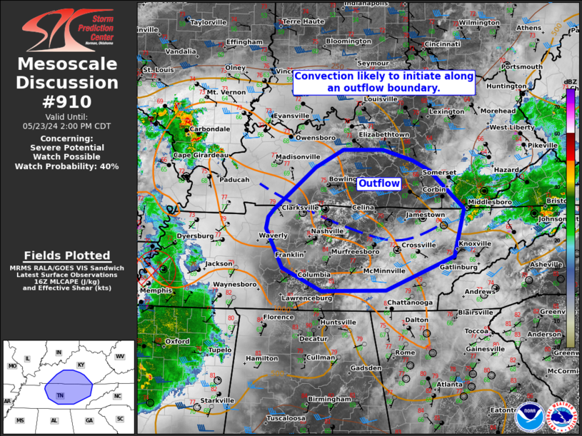
   Areas affected...Portions of Middle/Eastern Tennessee into
   south-central Kentucky

   Concerning...Severe potential...Watch possible

   Valid 231653Z - 231900Z

   Probability of Watch Issuance...40 percent

   SUMMARY...Damaging winds and isolated large hail will be possible
   with scattered storms this afternoon. A watch is possible for
   portions of Middle/Eastern Tennessee into central Kentucky if trends
   warrant.

   DISCUSSION...Cumulus have become more vertically developed along an
   outflow boundary in Middle Tennessee. With the approach of an MCV,
   now near Western Tennessee, and continued heating, storm coverage is
   likely to increase over the next few hours. Storm coverage into
   Kentucky may initially be limited, but daytime heating should
   destabilize the outflow by the afternoon. Wind damage will likely be
   the primary threat with scattered storms this afternoon. The 12Z
   observed BNA sounding showed mid-level lapse rates near 7 C/km and
   effective shear should modestly increase today. A few supercell
   structures could also produce large hail.

   ..Wendt/Hart.. 05/23/2024

   ...Please see www.spc.noaa.gov for graphic product...

   ATTN...WFO...MRX...JKL...LMK...OHX...HUN...PAH...

   LAT...LON   35318539 35308654 35668730 36288762 36458758 36578748
               37258666 37538612 37538535 37368476 37208443 36588376
               35848397 35318529 35318539
|
|
|
Top/All Mesoscale Discussions/Forecast Products/Home |
|


