|
|
| Mesoscale Discussion 900 | |
| < Previous MD | |

|
|
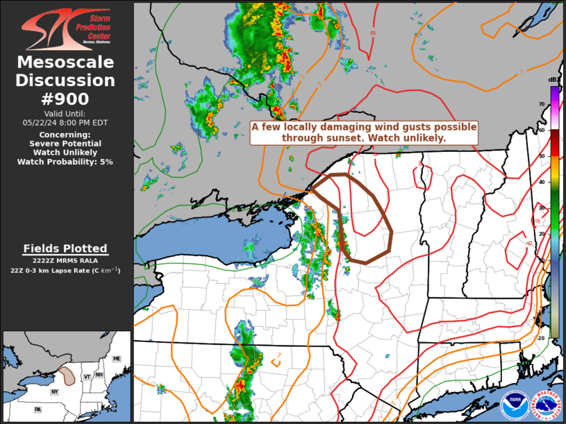
   Mesoscale Discussion 0900
   NWS Storm Prediction Center Norman OK
   0524 PM CDT Wed May 22 2024

   Areas affected...Portions of north-central New York and the western
   Adirondack Mountains

   Concerning...Severe potential...Watch unlikely

   Valid 222224Z - 230000Z

   Probability of Watch Issuance...5 percent

   SUMMARY...A few locally damaging wind gusts will be possible through
   sunset across the western Adirondack Mountains.

   DISCUSSION...A small cluster of generally decaying thunderstorms
   continues to progress northeastward across north-central NY this
   evening. These storms are moving into an environment currently
   characterized by marginal instability and weak deep layer shear.
   However, steep low-level lapse rates/moderate downdraft CAPE
   downstream will continue support some potential for severe damaging
   wind gusts, especially with merging thunderstorms. This potential
   will be limited in duration, though, as stabilization increases
   towards sunset. A watch is not likely at this time.

   ..Barnes.. 05/22/2024

   ...Please see www.spc.noaa.gov for graphic product...

   ATTN...WFO...BTV...ALY...

   LAT...LON   43347490 43507508 43847511 44117516 44307556 44437575
               44657535 44667501 44537475 44337442 44077422 43787404
               43487410 43287459 43347490
|
|
|
Top/All Mesoscale Discussions/Forecast Products/Home |
|
Source link