|
|
| Mesoscale Discussion 715 | |
| < Previous MD | |

|
|
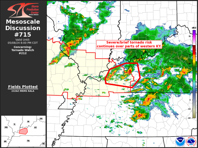
Mesoscale Discussion 0715 NWS Storm Prediction Center Norman OK 0629 PM CDT Wed May 08 2024 Areas affected...parts of western Kentucky Concerning...Tornado Watch 212... Valid 082329Z - 090100Z The severe weather threat for Tornado Watch 212 continues. SUMMARY...Severe/tornado risk continues across portions of western Kentucky, within Tornado Watch 212. DISCUSSION...Recent KLVX WSR-88D radar loop shows clusters of strong/severe storms moving eastward across eastern portions of WW 212 into WW 206 at this time. Widespread ongoing/prior convection across central Kentucky has resulted in a decrease in instability downstream, but moderately strong deep-layer southwesterly flow should support a continuation of the organized nature of the storms, along with associated risk for damaging wind gusts and marginal hail, along with potential for a brief tornado over the next 1 to 2 hours. ..Goss.. 05/08/2024 ...Please see www.spc.noaa.gov for graphic product... ATTN...WFO...LMK...PAH... LAT...LON 37158823 37518801 37748727 37738672 37188660 36828698 36978819 37158823 |
|
|
Top/All Mesoscale Discussions/Forecast Products/Home |
|