|
|
| Mesoscale Discussion 704 | |
| < Previous MD | |

|
|
   Mesoscale Discussion 0704
   NWS Storm Prediction Center Norman OK
   0217 PM CDT Wed May 08 2024

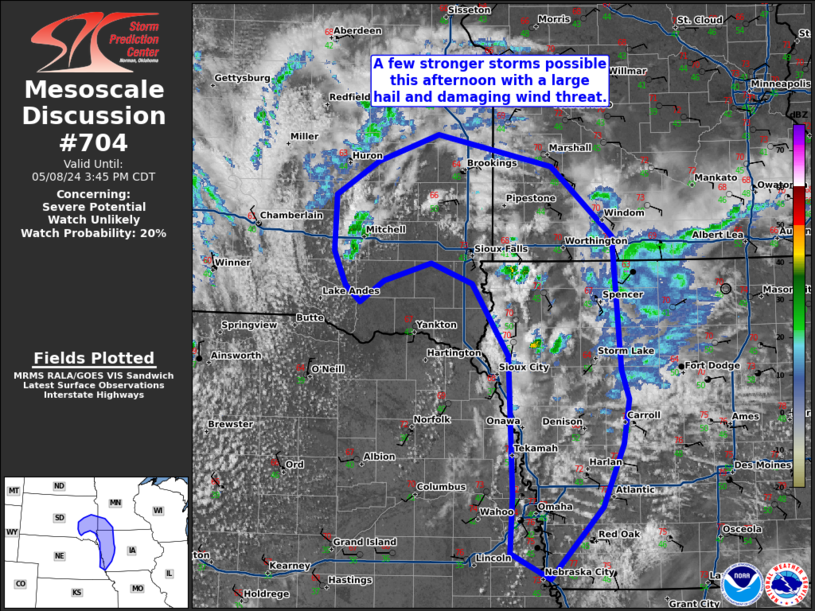
   Areas affected...southeast South dakota...southwest Minnesota...and
   western Iowa

   Concerning...Severe potential...Watch unlikely

   Valid 081917Z - 082045Z

   Probability of Watch Issuance...20 percent

   SUMMARY...A few stronger storms are possible this afternoon from
   southeast South Dakota into southwest Minnesota and western Iowa.

   DISCUSSION...An arcing band of showers/thunderstorms has started to
   appear on radar from southeast South Dakota into southwest Minnesota
   and into western Iowa. Moisture is lacking in this area, but cold
   air aloft (beneath the mid-level low) is supporting substantial
   instability and the potential for some stronger thunderstorms this
   afternoon. Cloud bases are high, but given the steep low-level lapse
   rates beneath an occluding low, some potential for
   landspout/non-supercell tornadoes exists.

   ..Bentley/Smith.. 05/08/2024

   ...Please see www.spc.noaa.gov for graphic product...

   ATTN...WFO...MPX...DMX...FSD...OAX...ABR...

   LAT...LON   42279481 41879487 41319513 40679575 40909624 41429620
               42659626 43299669 43489720 43329777 43139805 43289824
               43589837 44079835 44389785 44629712 44349573 43719500
               42539490 42279481
|
|
|
Top/All Mesoscale Discussions/Forecast Products/Home |
|


