|
|
| Mesoscale Discussion 655 | |
| < Previous MD | |

|
|
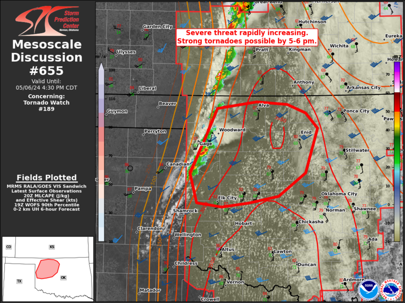
Mesoscale Discussion 0655 NWS Storm Prediction Center Norman OK 0335 PM CDT Mon May 06 2024 Areas affected...Northwest OK Concerning...Tornado Watch 189... Valid 062035Z - 062130Z The severe weather threat for Tornado Watch 189 continues. SUMMARY...Initial supercell development across northwest Oklahoma will pose a primary near-term risk for large to very large hail. Tornado threat should increase rapidly towards 5 to 6 pm. DISCUSSION...Most prominent convective development on the dryline south of KS has been in the Ellis county vicinity of northwest OK. Additional cells should form farther south towards I-40 based on the agitated CU field noted in the southeast TX Panhandle. These cells will likely evolve into long-track supercells as they mature with a primary initial threat of large to very large hail. OK-Mesonet surface observations confirm the leading edge of upper 60s dew points are along a line from roughly Tipton to Lahoma. As these cells impinge on the greater low-level buoyancy and stronger low-level shear over central OK (per comparison of FDR/TLX/VNX VWP data), potential for tornadoes will increase substantially during the early evening. This scenario is supported by recent WoFS guidance. ..Grams.. 05/06/2024 ...Please see www.spc.noaa.gov for graphic product... ATTN...WFO...OUN... LAT...LON 36819942 36909870 36869813 36739779 36519757 35839780 35489829 35399884 35339934 35389980 35849993 36359966 36819942 |
|
|
Top/All Mesoscale Discussions/Forecast Products/Home |
|


