|
|
| Mesoscale Discussion 612 | |
| < Previous MD | |

|
|
   Mesoscale Discussion 0612
   NWS Storm Prediction Center Norman OK
   0423 AM CDT Fri May 03 2024

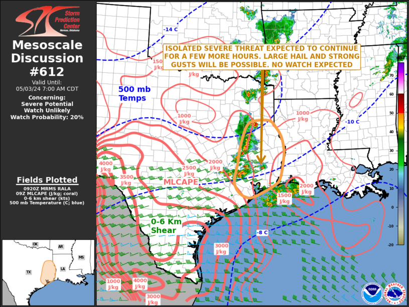
   Areas affected...East/Southeast Texas

   Concerning...Severe potential...Watch unlikely

   Valid 030923Z - 031200Z

   Probability of Watch Issuance...20 percent

   SUMMARY...Thunderstorms associated with isolated large hail and
   strong gusts are expected across parts of east Texas over the next
   few hours. The threat should remain marginal, and weather watch
   issuance appears unlikely.

   DISCUSSION...The latest high-resolution radar from Houston shows a
   cluster of strong thunderstorms over east Texas. The storms are
   developing in response to a large-scale ascent ahead of a shortwave
   trough, evident on water vapor imagery. RAP forecast soundings near
   the ongoing storms in east Texas early this morning have a low-level
   temperature inversion, with MUCAPE above the inversion generally
   around 1500 J/kg. Effective shear is in the 45 to 50 knot range, and
   700-500 mb lapse rates are between 7.0 and 7.5 C/km. This
   environment will support elevated storms with isolated large-hail
   potential. The severe threat is expected to move into far east Texas
   by daybreak, but should remain too marginal for watch issuance.

   ..Broyles/Edwards.. 05/03/2024

   ...Please see www.spc.noaa.gov for graphic product...

   ATTN...WFO...LCH...SHV...HGX...FWD...

   LAT...LON   29629577 29399562 29229534 29219497 29659405 29959378
               30669363 31079360 31569371 31919395 32199425 32179499
               31929531 31189558 30519569 29909583 29629577
|
|
|
Top/All Mesoscale Discussions/Forecast Products/Home |
|


