|
|
| Mesoscale Discussion 418 | |
| < Previous MD | |

|
|
   Mesoscale Discussion 0418
   NWS Storm Prediction Center Norman OK
   1258 AM CDT Thu Apr 11 2024

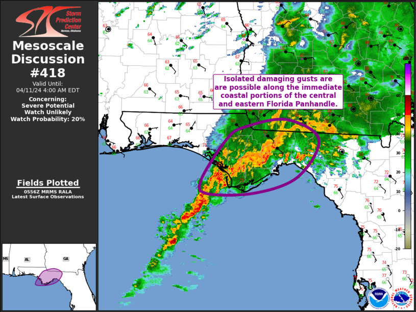
   Areas affected...Central/Eastern FL Panhandle

   Concerning...Severe potential...Watch unlikely

   Valid 110558Z - 110800Z

   Probability of Watch Issuance...20 percent

   SUMMARY...Isolated damaging gusts are possible along the immediate
   coastal portions of the central and eastern Florida Panhandle.

   DISCUSSION...More robust thunderstorms have developed across the
   central FL Panhandle over the past hour or so. A bowing segment
   recently moved across the region, producing a 50 kt gust at AAF and
   a few other near-severe gusts at mesonet sites in Franklin County.
   This band is moving quickly northeastward into a region with greater
   low-level stability. As a result, despite strong kinematic fields,
   the potential for damaging gusts to reach the surface will lessen
   with northward extent. The portion of the line moving into Wakulla
   County has the greatest potential to produce a few damaging gusts
   over the next half hour.

   Another band of strong thunderstorms has developed in the wake of
   the band moving through the region now, with much of this second
   band currently offshore. There is some potential for a few damaging
   gusts, mostly along the immediate coastal areas of Gulf and Franklin
   Counties, as this second band continues east-northeastward.

   ..Mosier/Smith.. 04/11/2024

   ...Please see www.spc.noaa.gov for graphic product...

   ATTN...WFO...TAE...

   LAT...LON   29808592 30538541 30768502 30898417 30538350 29858394
               29568483 29568582 29808592
|
|
|
Top/All Mesoscale Discussions/Forecast Products/Home |
|


