|
|
| Mesoscale Discussion 401 | |
| < Previous MD | |

|
|
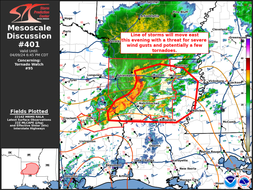
Mesoscale Discussion 0401 NWS Storm Prediction Center Norman OK 0517 PM CDT Tue Apr 09 2024 Areas affected...northern Louisiana Concerning...Tornado Watch 95... Valid 092217Z - 092345Z The severe weather threat for Tornado Watch 95 continues. SUMMARY...A line of storms will move east this evening with a threat for severe wind gusts and potentially a few tornadoes. DISCUSSION...A well organized bowing-segment continue east across northern Louisiana. This bow will continue to pose a threat for severe wind gusts. In addition, a few tornadoes are possible given around 150 m2/s2 0-1 SRH and several mesovorticies within the line. The greatest tornado potential may be on the northern periphery of the bow where the UDCZ is becoming more normal to the low-level shear vector. In addition, it appears a meso-low and potential "comma head" may be starting to form. Eventually, this line of storms will move into weaker instability and weaker low-level flow across Mississippi which will likely result in weakening of this bow. ..Bentley.. 04/09/2024 ...Please see www.spc.noaa.gov for graphic product... ATTN...WFO...JAN...LCH...SHV... LAT...LON 31349402 31579404 31879380 32069340 32249321 32439313 32689321 32879240 32779167 32409119 31629131 31299188 31339339 31349402 |
|
|
Top/All Mesoscale Discussions/Forecast Products/Home |
|
Source link


